
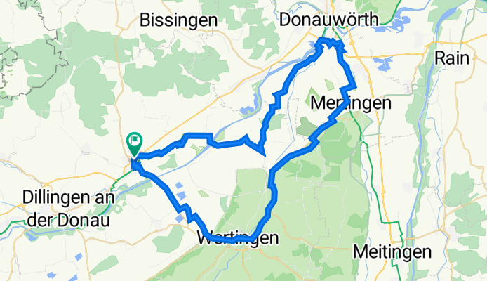
Zügle - Wertingen-Mertingen
A cycling route starting in Höchstädt an der Donau, Bavaria, Germany.
Overview
About this route
The railway route from Wertingen to Mertingen (about 19 km) is included in this beautiful bike tour from/to Höchstädt a.d.Donau. Tour description at: thod_er@gmx.de
- -:--
- Duration
- 63.1 km
- Distance
- 8,820 m
- Ascent
- 9,240 m
- Descent
- ---
- Avg. speed
- 447 m
- Max. altitude
Route quality
Waytypes & surfaces along the route
Waytypes
Path
20.8 km
(33 %)
Quiet road
15.1 km
(24 %)
Surfaces
Paved
49.8 km
(79 %)
Unpaved
3.8 km
(6 %)
Asphalt
49.2 km
(78 %)
Gravel
3.2 km
(5 %)
Continue with Bikemap
Use, edit, or download this cycling route
You would like to ride Zügle - Wertingen-Mertingen or customize it for your own trip? Here is what you can do with this Bikemap route:
Free features
- Save this route as favorite or in collections
- Copy & plan your own version of this route
- Sync your route with Garmin or Wahoo
Premium features
Free trial for 3 days, or one-time payment. More about Bikemap Premium.
- Navigate this route on iOS & Android
- Export a GPX / KML file of this route
- Create your custom printout (try it for free)
- Download this route for offline navigation
Discover more Premium features.
Get Bikemap PremiumFrom our community
Other popular routes starting in Höchstädt an der Donau
 D08 Höchstädt - Neuburg
- Distance
- 72.3 km
- Ascent
- 236 m
- Descent
- 278 m
- Location
- Höchstädt an der Donau, Bavaria, Germany
 NSR-72km 2008
- Distance
- 76.9 km
- Ascent
- 590 m
- Descent
- 579 m
- Location
- Höchstädt an der Donau, Bavaria, Germany
 Donau6 Höchstädt-Neuburg
- Distance
- 64.5 km
- Ascent
- 180 m
- Descent
- 217 m
- Location
- Höchstädt an der Donau, Bavaria, Germany
 18. etapa Hochstadt an der Donau - Ulm 60km
- Distance
- 58.4 km
- Ascent
- 89 m
- Descent
- 29 m
- Location
- Höchstädt an der Donau, Bavaria, Germany
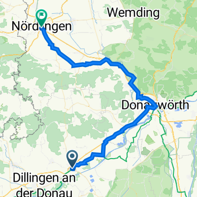 UT 05-2023: Höchstädt a.d. Donau - Nördlingen
- Distance
- 56.9 km
- Ascent
- 322 m
- Descent
- 302 m
- Location
- Höchstädt an der Donau, Bavaria, Germany
 Höchstädt - Katzenstein
- Distance
- 58.3 km
- Ascent
- 0 m
- Descent
- 0 m
- Location
- Höchstädt an der Donau, Bavaria, Germany
 Radtour 2023 - 10. Tag
- Distance
- 28.3 km
- Ascent
- 40 m
- Descent
- 54 m
- Location
- Höchstädt an der Donau, Bavaria, Germany
 201405-04 Iller - Donau - Zusam Höchstädt - Zusam - Markt Wald
- Distance
- 75.1 km
- Ascent
- 428 m
- Descent
- 214 m
- Location
- Höchstädt an der Donau, Bavaria, Germany
Open it in the app