

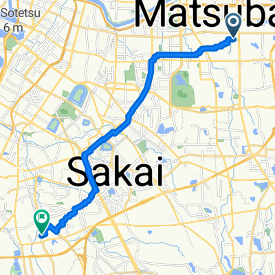
ツール・ド・堺 50kmコース逆走版
A cycling route starting in Matsubara, Osaka, Japan.
Overview
About this route
- -:--
- Duration
- 49.5 km
- Distance
- 756 m
- Ascent
- 744 m
- Descent
- ---
- Avg. speed
- ---
- Max. altitude

Route quality
Waytypes & surfaces along the route
Waytypes
Quiet road
20.8 km
(42 %)
Road
17.8 km
(36 %)
Surfaces
Paved
9.4 km
(19 %)
Asphalt
8.4 km
(17 %)
Paved (undefined)
1 km
(2 %)
Undefined
40.1 km
(81 %)
Continue with Bikemap
Use, edit, or download this cycling route
You would like to ride ツール・ド・堺 50kmコース逆走版 or customize it for your own trip? Here is what you can do with this Bikemap route:
Free features
- Save this route as favorite or in collections
- Copy & plan your own version of this route
- Sync your route with Garmin or Wahoo
Premium features
Free trial for 3 days, or one-time payment. More about Bikemap Premium.
- Navigate this route on iOS & Android
- Export a GPX / KML file of this route
- Create your custom printout (try it for free)
- Download this route for offline navigation
Discover more Premium features.
Get Bikemap PremiumFrom our community
Other popular routes starting in Matsubara
 季節の花をめぐる公園コース
- Distance
- 18.9 km
- Ascent
- 85 m
- Descent
- 89 m
- Location
- Matsubara, Osaka, Japan
 Japan 2023 Southtrip
- Distance
- 1,671.6 km
- Ascent
- 17,133 m
- Descent
- 17,132 m
- Location
- Matsubara, Osaka, Japan
 20200808
- Distance
- 16.8 km
- Ascent
- 86 m
- Descent
- 94 m
- Location
- Matsubara, Osaka, Japan
 1 - sakai to Himeji
- Distance
- 117 km
- Ascent
- 194 m
- Descent
- 120 m
- Location
- Matsubara, Osaka, Japan
 田井城2丁目, 松原市へ草部, 堺市
- Distance
- 13.7 km
- Ascent
- 33 m
- Descent
- 34 m
- Location
- Matsubara, Osaka, Japan
 6-17, Karita 9-Chōme, Sumiyoshi, Osaka to 17-28, Daisennakamachi, Sakai, Sakai
- Distance
- 16.2 km
- Ascent
- 32 m
- Descent
- 40 m
- Location
- Matsubara, Osaka, Japan
 ツール・ド・堺 50kmコース逆走版
- Distance
- 49.5 km
- Ascent
- 756 m
- Descent
- 744 m
- Location
- Matsubara, Osaka, Japan
 Kanaokacho, Kita-Ku, Sakai-Shi to Kanaokacho, Kita-Ku, Sakai-Shi
- Distance
- 0.4 km
- Ascent
- 3 m
- Descent
- 3 m
- Location
- Matsubara, Osaka, Japan
Open it in the app