

道の駅とよはし-渥美半島一周
A cycling route starting in Toyohashi, Aichi, Japan.
Overview
About this route
- -:--
- Duration
- 98.4 km
- Distance
- 519 m
- Ascent
- 516 m
- Descent
- ---
- Avg. speed
- ---
- Max. altitude

Continue with Bikemap
Use, edit, or download this cycling route
You would like to ride 道の駅とよはし-渥美半島一周 or customize it for your own trip? Here is what you can do with this Bikemap route:
Free features
- Save this route as favorite or in collections
- Copy & plan your own version of this route
- Split it into stages to create a multi-day tour
- Sync your route with Garmin or Wahoo
Premium features
Free trial for 3 days, or one-time payment. More about Bikemap Premium.
- Navigate this route on iOS & Android
- Export a GPX / KML file of this route
- Create your custom printout (try it for free)
- Download this route for offline navigation
Discover more Premium features.
Get Bikemap PremiumFrom our community
Other popular routes starting in Toyohashi
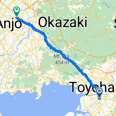 Toyohashi - Anjo
- Distance
- 44.1 km
- Ascent
- 265 m
- Descent
- 261 m
- Location
- Toyohashi, Aichi, Japan
 toyohasi-okadaya
- Distance
- 17.8 km
- Ascent
- 18 m
- Descent
- 28 m
- Location
- Toyohashi, Aichi, Japan
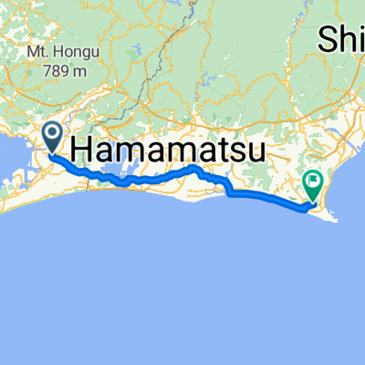 Okazaki - Hamamatsu
- Distance
- 92.7 km
- Ascent
- 533 m
- Descent
- 527 m
- Location
- Toyohashi, Aichi, Japan
 豊橋市〜大垣市
- Distance
- 110.7 km
- Ascent
- 509 m
- Descent
- 514 m
- Location
- Toyohashi, Aichi, Japan
 旧東海道自転車の旅~Day 5
- Distance
- 90.7 km
- Ascent
- 202 m
- Descent
- 200 m
- Location
- Toyohashi, Aichi, Japan
 道の駅とよはし-渥美半島一周
- Distance
- 98.4 km
- Ascent
- 519 m
- Descent
- 516 m
- Location
- Toyohashi, Aichi, Japan
 豊橋〜岐阜
豊橋〜岐阜- Distance
- 104.2 km
- Ascent
- 338 m
- Descent
- 365 m
- Location
- Toyohashi, Aichi, Japan
 Moderate route in Toyohashi-Shi
- Distance
- 48.6 km
- Ascent
- 1,028 m
- Descent
- 1,024 m
- Location
- Toyohashi, Aichi, Japan
Open it in the app