

Sunday trip 200927
A cycling route starting in Södertälje, Stockholm County, Sweden.
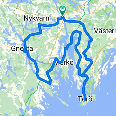
Overview
About this route
Nature exploring
- -:--
- Duration
- 84.3 km
- Distance
- 395 m
- Ascent
- 395 m
- Descent
- ---
- Avg. speed
- ---
- Max. altitude

Route quality
Waytypes & surfaces along the route
Waytypes
Quiet road
41.8 km
(50 %)
Road
18.1 km
(21 %)
Surfaces
Paved
37.6 km
(45 %)
Unpaved
33.2 km
(39 %)
Asphalt
36.4 km
(43 %)
Gravel
26.9 km
(32 %)
Continue with Bikemap
Use, edit, or download this cycling route
You would like to ride Sunday trip 200927 or customize it for your own trip? Here is what you can do with this Bikemap route:
Free features
- Save this route as favorite or in collections
- Copy & plan your own version of this route
- Split it into stages to create a multi-day tour
- Sync your route with Garmin or Wahoo
Premium features
Free trial for 3 days, or one-time payment. More about Bikemap Premium.
- Navigate this route on iOS & Android
- Export a GPX / KML file of this route
- Create your custom printout (try it for free)
- Download this route for offline navigation
Discover more Premium features.
Get Bikemap PremiumFrom our community
Other popular routes starting in Södertälje
 Bikepack
- Distance
- 279.3 km
- Ascent
- 3,202 m
- Descent
- 3,202 m
- Location
- Södertälje, Stockholm County, Sweden
 rando2
- Distance
- 205.7 km
- Ascent
- 452 m
- Descent
- 452 m
- Location
- Södertälje, Stockholm County, Sweden
 Södertälje-Taxinge-Järna
- Distance
- 81.4 km
- Ascent
- 297 m
- Descent
- 301 m
- Location
- Södertälje, Stockholm County, Sweden
 Summer 2021 - Södertälje till Vänersborg
- Distance
- 448.4 km
- Ascent
- 494 m
- Descent
- 463 m
- Location
- Södertälje, Stockholm County, Sweden
 Södertälje - Örebro Dag 1: Södertälje - Eklången
- Distance
- 72 km
- Ascent
- 805 m
- Descent
- 799 m
- Location
- Södertälje, Stockholm County, Sweden
 Kakslottet
- Distance
- 25.4 km
- Ascent
- 299 m
- Descent
- 326 m
- Location
- Södertälje, Stockholm County, Sweden
 Södertälje Cycling
- Distance
- 27.5 km
- Ascent
- 345 m
- Descent
- 350 m
- Location
- Södertälje, Stockholm County, Sweden
 Sandviken to Lurberget viewpoint
- Distance
- 10.8 km
- Ascent
- 161 m
- Descent
- 154 m
- Location
- Södertälje, Stockholm County, Sweden
Open it in the app