

Moselsteig Etappe 18: Beilstein – Cochem
A cycling route starting in Beilstein, Rhineland-Palatinate, Germany.
Overview
About this route
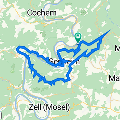
On the trails of the steep slope winemakers. / Those who have tackled this stage and its numerous steep slopes can appreciate the efforts that vine growing along the Moselle involves. The rocky paths along the edge of the slope require a certain surefootedness, but offer unforgettable views over the Moselle for long stretches. Finally, the path leads beneath the vertical rock face of Brauselay, from where the stage destination, Cochem, is already in sight, dominated by its fairytale-like beautiful castle, Reichsburg. With this beautiful goal in mind, the Moselsteig descends into the hospitable town.
- -:--
- Duration
- 13.8 km
- Distance
- 542 m
- Ascent
- 541 m
- Descent
- ---
- Avg. speed
- ---
- Max. altitude
Continue with Bikemap
Use, edit, or download this cycling route
You would like to ride Moselsteig Etappe 18: Beilstein – Cochem or customize it for your own trip? Here is what you can do with this Bikemap route:
Free features
- Save this route as favorite or in collections
- Copy & plan your own version of this route
- Sync your route with Garmin or Wahoo
Premium features
Free trial for 3 days, or one-time payment. More about Bikemap Premium.
- Navigate this route on iOS & Android
- Export a GPX / KML file of this route
- Create your custom printout (try it for free)
- Download this route for offline navigation
Discover more Premium features.
Get Bikemap PremiumFrom our community
Other popular routes starting in Beilstein
 Mosel 4
- Distance
- 65.6 km
- Ascent
- 204 m
- Descent
- 163 m
- Location
- Beilstein, Rhineland-Palatinate, Germany
 Moselsteig Etappe 18: Beilstein – Cochem
- Distance
- 13.8 km
- Ascent
- 542 m
- Descent
- 541 m
- Location
- Beilstein, Rhineland-Palatinate, Germany
 Mosel radweg COCHEM
- Distance
- 42.6 km
- Ascent
- 120 m
- Descent
- 121 m
- Location
- Beilstein, Rhineland-Palatinate, Germany
 Ellenz-Koblenz
- Distance
- 65.6 km
- Ascent
- 186 m
- Descent
- 206 m
- Location
- Beilstein, Rhineland-Palatinate, Germany
 Im Mühlental 6, Beilstein nach Bachstraße 39, Beilstein
- Distance
- 53.1 km
- Ascent
- 987 m
- Descent
- 1,007 m
- Location
- Beilstein, Rhineland-Palatinate, Germany
 Beilstein Tag 48,5 km
- Distance
- 48.5 km
- Ascent
- 1,140 m
- Descent
- 1,142 m
- Location
- Beilstein, Rhineland-Palatinate, Germany
 Mosel Trail
- Distance
- 13.9 km
- Ascent
- 350 m
- Descent
- 360 m
- Location
- Beilstein, Rhineland-Palatinate, Germany
 Aerobic-Girls on tour - Von Ellenz nach Ernst
- Distance
- 8.3 km
- Ascent
- 225 m
- Descent
- 256 m
- Location
- Beilstein, Rhineland-Palatinate, Germany
Open it in the app