

Sledi divjine (Risov krog)
A cycling route starting in Črna na Koroškem, Črna na Koroškem Municipality, Slovenia.
Overview
About this route
Traces of the wilderness (Risov krog)
A labyrinth of forest roads and paths marked or described in guides for mountain biking through valleys and around them, on mountains and their surroundings is called Traces of the wilderness. The routes, which mostly follow forest roads, paths, and less trafficked, mainly gravel roads, are marked with animal footprints. The base, information, service, and accommodation cycling center is at the Ekohotel Kmetija Koroš, with the starting point for most routes in the center of Črna na Koroškem.
The landscape at the junction of the Eastern and Central Alps is characterized by narrow mountain valleys with steep slopes intertwined with numerous forest roads, as the forest covers almost two-thirds of the area. Larger settlements are concentrated in the valley, while higher-lying parts of the landscape are characterized by isolated farms in the form of groups. Among the picturesque mountain valleys, the Topla on the southern fringes of Pece stands out, protected as a landscape park due to its unique cultural landscape and natural environment.
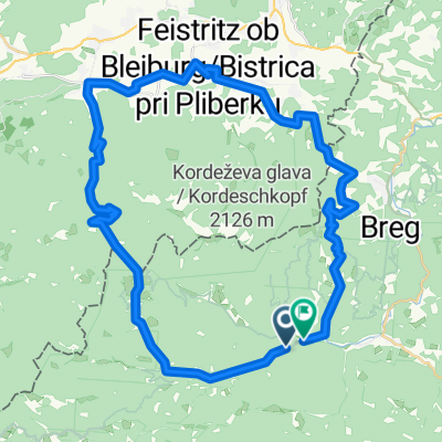
- -:--
- Duration
- 18.6 km
- Distance
- 636 m
- Ascent
- 637 m
- Descent
- ---
- Avg. speed
- ---
- Max. altitude

Route quality
Waytypes & surfaces along the route
Waytypes
Track
10.4 km
(56 %)
Quiet road
5.6 km
(30 %)
Surfaces
Paved
5.2 km
(28 %)
Unpaved
8 km
(43 %)
Gravel
4.6 km
(25 %)
Paved (undefined)
4.3 km
(23 %)
Continue with Bikemap
Use, edit, or download this cycling route
You would like to ride Sledi divjine (Risov krog) or customize it for your own trip? Here is what you can do with this Bikemap route:
Free features
- Save this route as favorite or in collections
- Copy & plan your own version of this route
- Sync your route with Garmin or Wahoo
Premium features
Free trial for 3 days, or one-time payment. More about Bikemap Premium.
- Navigate this route on iOS & Android
- Export a GPX / KML file of this route
- Create your custom printout (try it for free)
- Download this route for offline navigation
Discover more Premium features.
Get Bikemap PremiumFrom our community
Other popular routes starting in Črna na Koroškem
 Pudgarsko-Bela Peč-Travnik-Črno jezero-Dom na Smrekovcu-Pudgarsko
- Distance
- 40.4 km
- Ascent
- 1,275 m
- Descent
- 1,275 m
- Location
- Črna na Koroškem, Črna na Koroškem Municipality, Slovenia
 Sledi divjine (Kunin krog)
- Distance
- 16.5 km
- Ascent
- 571 m
- Descent
- 572 m
- Location
- Črna na Koroškem, Črna na Koroškem Municipality, Slovenia
 Sledi divjine (Risov krog)
- Distance
- 18.6 km
- Ascent
- 636 m
- Descent
- 637 m
- Location
- Črna na Koroškem, Črna na Koroškem Municipality, Slovenia
 ČRNA ADRIATIC RACE
- Distance
- 237.9 km
- Ascent
- 1,287 m
- Descent
- 1,862 m
- Location
- Črna na Koroškem, Črna na Koroškem Municipality, Slovenia
 BLACKHOLE MARATON
- Distance
- 49.9 km
- Ascent
- 1,625 m
- Descent
- 1,625 m
- Location
- Črna na Koroškem, Črna na Koroškem Municipality, Slovenia
 Sledi divjine (Gamsov krog)
- Distance
- 29 km
- Ascent
- 859 m
- Descent
- 857 m
- Location
- Črna na Koroškem, Črna na Koroškem Municipality, Slovenia
 Podpeca to Podpeca
- Distance
- 48.4 km
- Ascent
- 2,322 m
- Descent
- 2,343 m
- Location
- Črna na Koroškem, Črna na Koroškem Municipality, Slovenia
 Center 142, Črna na Koroškem nach Lampreče 1, Črna na Koroškem
- Distance
- 49.6 km
- Ascent
- 2,419 m
- Descent
- 2,410 m
- Location
- Črna na Koroškem, Črna na Koroškem Municipality, Slovenia
Open it in the app