

Le Mâconnais en VTT
A cycling route starting in Pont-de-Vaux, Auvergne-Rhône-Alpes, France.
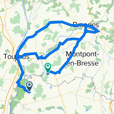
Overview
About this route
Start: parking lot of the Viré community hall
Allow 2h30
- -:--
- Duration
- 34 km
- Distance
- 769 m
- Ascent
- 769 m
- Descent
- ---
- Avg. speed
- ---
- Max. altitude

Route highlights
Points of interest along the route
Point of interest after 6.1 km
Entrée de la carrière de Lugny
Point of interest after 12.6 km
Chapelle de charcuble (point d'eau à l'entrée du parking)
Point of interest after 14.1 km
Mont Saint Romain 1 Restaurant 2 vue panoramique sur la côte châlonnaise
Point of interest after 19.2 km
Chateau de Cruzille
Point of interest after 29.2 km
Chapelle de Burgy ravitaillement possible (point d'eau sur le parking)
Point of interest after 30.8 km
Croix de la Sainte Barbe croix en bois portion en singletracks
Continue with Bikemap
Use, edit, or download this cycling route
You would like to ride Le Mâconnais en VTT or customize it for your own trip? Here is what you can do with this Bikemap route:
Free features
- Save this route as favorite or in collections
- Copy & plan your own version of this route
- Sync your route with Garmin or Wahoo
Premium features
Free trial for 3 days, or one-time payment. More about Bikemap Premium.
- Navigate this route on iOS & Android
- Export a GPX / KML file of this route
- Create your custom printout (try it for free)
- Download this route for offline navigation
Discover more Premium features.
Get Bikemap PremiumFrom our community
Other popular routes starting in Pont-de-Vaux
 10ième etappe: Fleurville à Chalon s/Saone
- Distance
- 56.8 km
- Ascent
- 85 m
- Descent
- 69 m
- Location
- Pont-de-Vaux, Auvergne-Rhône-Alpes, France
 Panorama sur Cluny
- Distance
- 36.1 km
- Ascent
- 857 m
- Descent
- 860 m
- Location
- Pont-de-Vaux, Auvergne-Rhône-Alpes, France
 Viré-Cruzille
- Distance
- 26.8 km
- Ascent
- 634 m
- Descent
- 633 m
- Location
- Pont-de-Vaux, Auvergne-Rhône-Alpes, France
 TourdeF2012_E05
- Distance
- 110.1 km
- Ascent
- 834 m
- Descent
- 744 m
- Location
- Pont-de-Vaux, Auvergne-Rhône-Alpes, France
 vergekijking route hel. en off. route
- Distance
- 135.2 km
- Ascent
- 607 m
- Descent
- 595 m
- Location
- Pont-de-Vaux, Auvergne-Rhône-Alpes, France
 70 Route de Planaise, Chavannes-sur-Reyssouze à 70 Route de Planaise, Chavannes-sur-Reyssouze
- Distance
- 20.2 km
- Ascent
- 120 m
- Descent
- 120 m
- Location
- Pont-de-Vaux, Auvergne-Rhône-Alpes, France
 Le Mâconnais en VTT
- Distance
- 34 km
- Ascent
- 769 m
- Descent
- 769 m
- Location
- Pont-de-Vaux, Auvergne-Rhône-Alpes, France
 Gilles Berthoud
- Distance
- 51.2 km
- Ascent
- ---
- Descent
- ---
- Location
- Pont-de-Vaux, Auvergne-Rhône-Alpes, France
Open it in the app