

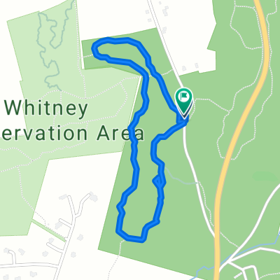
Grafton
A cycling route starting in Upton, Massachusetts, United States.
Overview
About this route
- 39 min
- Duration
- 4.6 km
- Distance
- 129 m
- Ascent
- 132 m
- Descent
- 7 km/h
- Avg. speed
- ---
- Max. altitude

Route quality
Waytypes & surfaces along the route
Waytypes
Pedestrian area
2.1 km
(46 %)
Path
1.6 km
(35 %)
Surfaces
Unpaved
0.9 km
(20 %)
Unpaved (undefined)
0.9 km
(20 %)
Undefined
3.7 km
(80 %)
Continue with Bikemap
Use, edit, or download this cycling route
You would like to ride Grafton or customize it for your own trip? Here is what you can do with this Bikemap route:
Free features
- Save this route as favorite or in collections
- Copy & plan your own version of this route
- Sync your route with Garmin or Wahoo
Premium features
Free trial for 3 days, or one-time payment. More about Bikemap Premium.
- Navigate this route on iOS & Android
- Export a GPX / KML file of this route
- Create your custom printout (try it for free)
- Download this route for offline navigation
Discover more Premium features.
Get Bikemap PremiumFrom our community
Other popular routes starting in Upton
 Whitehall / Mammoth Rock / Middle Rd route
- Distance
- 11.5 km
- Ascent
- 269 m
- Descent
- 241 m
- Location
- Upton, Massachusetts, United States
 56 Forest St, Upton to 56 Forest St, Upton
- Distance
- 7.7 km
- Ascent
- 88 m
- Descent
- 84 m
- Location
- Upton, Massachusetts, United States
 56 Forest St, Upton to 56 Forest St, Upton
- Distance
- 7.9 km
- Ascent
- 88 m
- Descent
- 101 m
- Location
- Upton, Massachusetts, United States
 Grafton
- Distance
- 4.6 km
- Ascent
- 129 m
- Descent
- 132 m
- Location
- Upton, Massachusetts, United States
 Upton Road
- Distance
- 27.6 km
- Ascent
- 310 m
- Descent
- 298 m
- Location
- Upton, Massachusetts, United States
 56 Forest St, Upton to 57 Forest St, Upton
- Distance
- 6.6 km
- Ascent
- 97 m
- Descent
- 98 m
- Location
- Upton, Massachusetts, United States
 Whitehall route + Dean Pond
- Distance
- 7.4 km
- Ascent
- 141 m
- Descent
- 151 m
- Location
- Upton, Massachusetts, United States
 Ridge Rd, Upton to Ridge Rd, Upton
- Distance
- 2 km
- Ascent
- 84 m
- Descent
- 84 m
- Location
- Upton, Massachusetts, United States
Open it in the app