

Tatranský okruh
A cycling route starting in Kežmarok, Prešov Region, Slovakia.
Overview
About this route
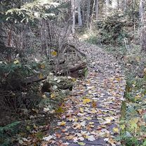
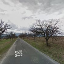
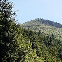
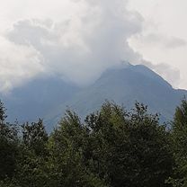
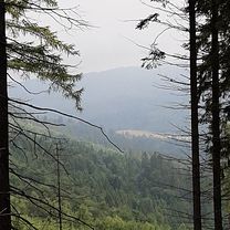
We start the route in the town of Kežmarok and continue along the local road through Vrbov and Žakovce, from where we connect to a little-used road around the Úsvit landfill to the Stráže district of Poprad, from where we reach the cycle path to Svit. After Svit, we turn left towards the Lopušná Valley, but after a few meters we leave the asphalt road and turn right onto a dirt road, which will take us to the village of Lučivná, then onward to Štrba and Tatranská Štrba. From there, the hardest ascent of the route to Štrbské Pleso starts, which is more than 10 kilometers long. After visiting the New and Old Lakes at Štrbské Pleso, we descend back to the intersection below Štrbské Pleso and continue through Vyšné Hágy, Smokovce, Tatranská Lomnica to the Tatranská Kotlina intersection, where we turn right towards Spišská Belá. In Spišská Belá, we continue towards Kežmarok where we close the Tatranský loop.
- -:--
- Duration
- 97.4 km
- Distance
- 1,296 m
- Ascent
- 1,220 m
- Descent
- ---
- Avg. speed
- 1,341 m
- Max. altitude

Route quality
Waytypes & surfaces along the route
Waytypes
Quiet road
13.6 km
(14 %)
Road
12.7 km
(13 %)
Surfaces
Paved
75 km
(77 %)
Unpaved
6.8 km
(7 %)
Asphalt
74 km
(76 %)
Gravel
4.9 km
(5 %)
Continue with Bikemap
Use, edit, or download this cycling route
You would like to ride Tatranský okruh or customize it for your own trip? Here is what you can do with this Bikemap route:
Free features
- Save this route as favorite or in collections
- Copy & plan your own version of this route
- Split it into stages to create a multi-day tour
- Sync your route with Garmin or Wahoo
Premium features
Free trial for 3 days, or one-time payment. More about Bikemap Premium.
- Navigate this route on iOS & Android
- Export a GPX / KML file of this route
- Create your custom printout (try it for free)
- Download this route for offline navigation
Discover more Premium features.
Get Bikemap PremiumFrom our community
Other popular routes starting in Kežmarok
 Lanškrounská 15 do Lanškrounská 13
- Distance
- 45.1 km
- Ascent
- 568 m
- Descent
- 626 m
- Location
- Kežmarok, Prešov Region, Slovakia
 Día 4. Kezmarok - Tatry - Liptovsky Mikulas
- Distance
- 82.1 km
- Ascent
- 738 m
- Descent
- 784 m
- Location
- Kežmarok, Prešov Region, Slovakia
 Lanškrounská 15 do Lanškrounská 13
- Distance
- 53.7 km
- Ascent
- 1,229 m
- Descent
- 1,281 m
- Location
- Kežmarok, Prešov Region, Slovakia
 Lanškrounská 15 do Lanškrounská 15
- Distance
- 38.9 km
- Ascent
- 634 m
- Descent
- 609 m
- Location
- Kežmarok, Prešov Region, Slovakia
 Lanškrounská 15 do Lanškrounská 13
- Distance
- 24.5 km
- Ascent
- 591 m
- Descent
- 584 m
- Location
- Kežmarok, Prešov Region, Slovakia
 Lanškrounská 13 do Lanškrounská 15
- Distance
- 43.2 km
- Ascent
- 509 m
- Descent
- 454 m
- Location
- Kežmarok, Prešov Region, Slovakia
 Lanškrounská 15 do Lanškrounská 15
- Distance
- 36.9 km
- Ascent
- 696 m
- Descent
- 685 m
- Location
- Kežmarok, Prešov Region, Slovakia
 Tatranský okruh
- Distance
- 97.4 km
- Ascent
- 1,296 m
- Descent
- 1,220 m
- Location
- Kežmarok, Prešov Region, Slovakia
Open it in the app