

Vigo-Silleiro-Vigo
A cycling route starting in Vigo, Galicia, Spain.
Overview
About this route
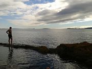
Ruta en bici, todo asfaltado. Se sale de Vigo y a la ida hacía Silleiro se va por la costa, sin prácticamente pendientes. Acaba en una rampa de 800 metros que termina en el faro.
A la vuelta se va uno hacia Vigo por el interior con unas cuantas rampas entre los km 40 y 50.
- -:--
- Duration
- 57 km
- Distance
- 405 m
- Ascent
- 401 m
- Descent
- ---
- Avg. speed
- ---
- Max. altitude
Route quality
Waytypes & surfaces along the route
Waytypes
Busy road
37.5 km
(66 %)
Quiet road
9.1 km
(16 %)
Surfaces
Paved
27 km
(47 %)
Asphalt
26.2 km
(46 %)
Concrete
0.6 km
(1 %)
Continue with Bikemap
Use, edit, or download this cycling route
You would like to ride Vigo-Silleiro-Vigo or customize it for your own trip? Here is what you can do with this Bikemap route:
Free features
- Save this route as favorite or in collections
- Copy & plan your own version of this route
- Sync your route with Garmin or Wahoo
Premium features
Free trial for 3 days, or one-time payment. More about Bikemap Premium.
- Navigate this route on iOS & Android
- Export a GPX / KML file of this route
- Create your custom printout (try it for free)
- Download this route for offline navigation
Discover more Premium features.
Get Bikemap PremiumFrom our community
Other popular routes starting in Vigo
 Coia-Hermita Monte Alba
- Distance
- 12.1 km
- Ascent
- 503 m
- Descent
- 80 m
- Location
- Vigo, Galicia, Spain
 Coia- Samil-Paseo Lagares
- Distance
- 12.3 km
- Ascent
- 79 m
- Descent
- 100 m
- Location
- Vigo, Galicia, Spain
 El atardecer
- Distance
- 23.8 km
- Ascent
- 190 m
- Descent
- 194 m
- Location
- Vigo, Galicia, Spain
 Seara-Chandebrito-Seara
- Distance
- 35.4 km
- Ascent
- 553 m
- Descent
- 556 m
- Location
- Vigo, Galicia, Spain
 Ruta del Agua 1ª parte
- Distance
- 32.8 km
- Ascent
- 285 m
- Descent
- 285 m
- Location
- Vigo, Galicia, Spain
 Vigo-Presa Eiras (ruta agua)
- Distance
- 87.5 km
- Ascent
- 642 m
- Descent
- 662 m
- Location
- Vigo, Galicia, Spain
 Ruta del agua
- Distance
- 40 km
- Ascent
- 346 m
- Descent
- 386 m
- Location
- Vigo, Galicia, Spain
 Los tres puertos
- Distance
- 69.7 km
- Ascent
- 1,080 m
- Descent
- 1,080 m
- Location
- Vigo, Galicia, Spain
Open it in the app