Seedorf - Eschachtal - Hohenkarpfen - Klippeneck
A cycling route starting in Seedorf, Baden-Wurttemberg, Germany.
Overview
About this route
Day trip for MTB and trekking bikes. Very versatile trails, beautiful views and relaxing paths. There's something for everyone. Recommended stop at Klippeneck.
- -:--
- Duration
- 102 km
- Distance
- 1,003 m
- Ascent
- 1,002 m
- Descent
- ---
- Avg. speed
- ---
- Max. altitude
Continue with Bikemap
Use, edit, or download this cycling route
You would like to ride Seedorf - Eschachtal - Hohenkarpfen - Klippeneck or customize it for your own trip? Here is what you can do with this Bikemap route:
Free features
- Save this route as favorite or in collections
- Copy & plan your own version of this route
- Split it into stages to create a multi-day tour
- Sync your route with Garmin or Wahoo
Premium features
Free trial for 3 days, or one-time payment. More about Bikemap Premium.
- Navigate this route on iOS & Android
- Export a GPX / KML file of this route
- Create your custom printout (try it for free)
- Download this route for offline navigation
Discover more Premium features.
Get Bikemap PremiumFrom our community
Other popular routes starting in Seedorf
Waldmössingen-Flugplatz Winzeln-Rötenberg-Aichhalden-Sulgen-Beschenhof-Dunningen-Seedorf-Waldmössingen- Distance
- 34.8 km
- Ascent
- 238 m
- Descent
- 238 m
- Location
- Seedorf, Baden-Wurttemberg, Germany
Seedorf-Tennenbronn-Windkapf- Distance
- 54.9 km
- Ascent
- 925 m
- Descent
- 906 m
- Location
- Seedorf, Baden-Wurttemberg, Germany
Von Waldmössingen durch die Gäulandschaft- Distance
- 45.4 km
- Ascent
- 287 m
- Descent
- 279 m
- Location
- Seedorf, Baden-Wurttemberg, Germany
Römerstrasse- Distance
- 32.4 km
- Ascent
- 270 m
- Descent
- 270 m
- Location
- Seedorf, Baden-Wurttemberg, Germany
Seedorf - Schonach - Gutach - Aichhalden- Distance
- 94.5 km
- Ascent
- 1,308 m
- Descent
- 1,565 m
- Location
- Seedorf, Baden-Wurttemberg, Germany
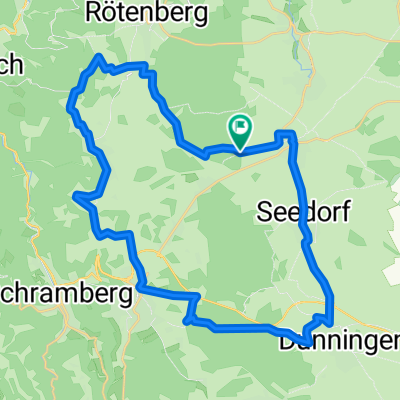
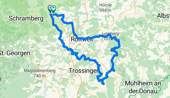
Seedorf-Tennenbronn-Mosenmättle- Distance
- 62.6 km
- Ascent
- 1,386 m
- Descent
- 1,373 m
- Location
- Seedorf, Baden-Wurttemberg, Germany
Seedorf - Hardt - Furtwangen (Genussrunde)- Distance
- 70.5 km
- Ascent
- 913 m
- Descent
- 805 m
- Location
- Seedorf, Baden-Wurttemberg, Germany
Sulgen-Windkapf-Lauterbach-Schramberg- Distance
- 68.3 km
- Ascent
- 1,443 m
- Descent
- 1,388 m
- Location
- Seedorf, Baden-Wurttemberg, Germany
Open it in the app

