

2020 Puszcza Karpacka dzień 2
A cycling route starting in Olszanica, Subcarpathian Voivodeship, Poland.
Overview
About this route
14.8 km of terrain.
- -:--
- Duration
- 67.6 km
- Distance
- 1,121 m
- Ascent
- 1,121 m
- Descent
- ---
- Avg. speed
- ---
- Max. altitude

Route highlights
Points of interest along the route

Photo after 6.5 km
Kilkusetletnia jodła w Paśmie Krzemienia.

Photo after 16.1 km
Zimowit jesienny w Krajnej.

Photo after 21.8 km
Rzeka Wiar w Trójcy.

Photo after 35.1 km
Zielony Szlak Arłamowski.

Photo after 41.1 km
Zdziczałe sady w Grąziowej.

Photo after 55.3 km
W Paśmie Chwaniowa.
Continue with Bikemap
Use, edit, or download this cycling route
You would like to ride 2020 Puszcza Karpacka dzień 2 or customize it for your own trip? Here is what you can do with this Bikemap route:
Free features
- Save this route as favorite or in collections
- Copy & plan your own version of this route
- Sync your route with Garmin or Wahoo
Premium features
Free trial for 3 days, or one-time payment. More about Bikemap Premium.
- Navigate this route on iOS & Android
- Export a GPX / KML file of this route
- Create your custom printout (try it for free)
- Download this route for offline navigation
Discover more Premium features.
Get Bikemap PremiumFrom our community
Other popular routes starting in Olszanica
 Perły Podk-3
- Distance
- 53.4 km
- Ascent
- 667 m
- Descent
- 744 m
- Location
- Olszanica, Subcarpathian Voivodeship, Poland
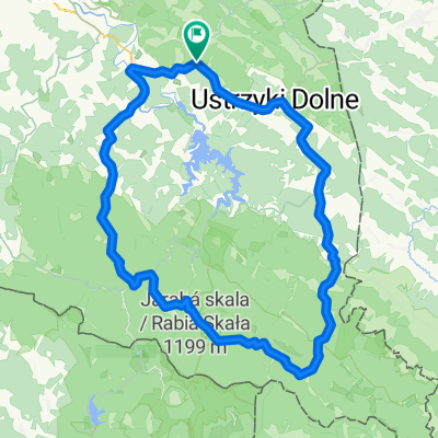
 2.03.2017 Olszanica - Ustrzyki Dolne
- Distance
- 13.2 km
- Ascent
- 135 m
- Descent
- 56 m
- Location
- Olszanica, Subcarpathian Voivodeship, Poland
 Przez Arłamów i Kwaszeninę
- Distance
- 49.5 km
- Ascent
- 590 m
- Descent
- 593 m
- Location
- Olszanica, Subcarpathian Voivodeship, Poland
 Myczkowce Route 1
- Distance
- 68.6 km
- Ascent
- 583 m
- Descent
- 583 m
- Location
- Olszanica, Subcarpathian Voivodeship, Poland
 przez Ropienkę do Ustrzyk Dolnych
- Distance
- 69 km
- Ascent
- 745 m
- Descent
- 747 m
- Location
- Olszanica, Subcarpathian Voivodeship, Poland
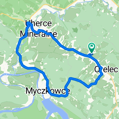 2013 07 Bieszczady: Orelec - Myczkowce
- Distance
- 13.7 km
- Ascent
- 174 m
- Descent
- 172 m
- Location
- Olszanica, Subcarpathian Voivodeship, Poland
 Klasyk bieszczadzki-Pętla duża
- Distance
- 143.1 km
- Ascent
- 1,160 m
- Descent
- 1,161 m
- Location
- Olszanica, Subcarpathian Voivodeship, Poland
 Olszanica 185, Olszanica do Olszanica 194, Olszanica
- Distance
- 36 km
- Ascent
- 632 m
- Descent
- 637 m
- Location
- Olszanica, Subcarpathian Voivodeship, Poland
Open it in the app