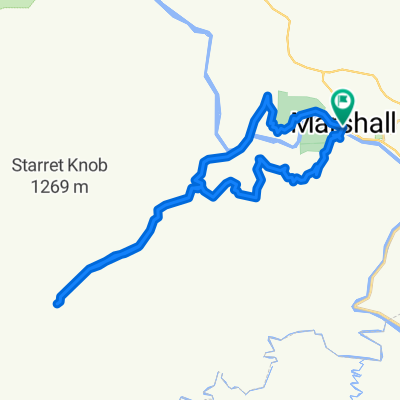
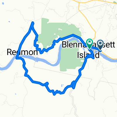
Marshall to Little Pine Creek
A cycling route starting in Marshall, North Carolina, United States of America.
Overview
About this route
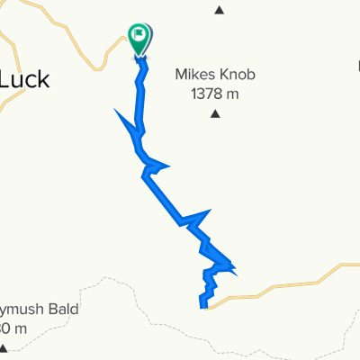
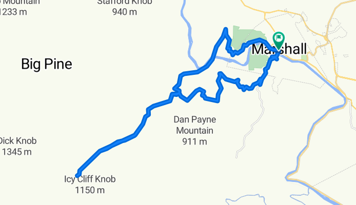
Start at Marshall, top two peaks and follow Pine Creek to base of Grassland Mountain. Return via Redmon bridge. 20.5 miles round trip.
- -:--
- Duration
- 33.3 km
- Distance
- 596 m
- Ascent
- 595 m
- Descent
- ---
- Avg. speed
- ---
- Avg. speed
Route quality
Waytypes & surfaces along the route
Waytypes
Quiet road
30.3 km
(91 %)
Road
2.8 km
(8 %)
Surfaces
Paved
25.1 km
(75 %)
Unpaved
2.5 km
(8 %)
Asphalt
24.9 km
(75 %)
Gravel
2.5 km
(8 %)
Continue with Bikemap
Use, edit, or download this cycling route
You would like to ride Marshall to Little Pine Creek or customize it for your own trip? Here is what you can do with this Bikemap route:
Free features
- Save this route as favorite or in collections
- Copy & plan your own version of this route
- Sync your route with Garmin or Wahoo
Premium features
Free trial for 3 days, or one-time payment. More about Bikemap Premium.
- Navigate this route on iOS & Android
- Export a GPX / KML file of this route
- Create your custom printout (try it for free)
- Download this route for offline navigation
Discover more Premium features.
Get Bikemap PremiumFrom our community
Other popular routes starting in Marshall
- Hot Springs lollipop to Cove Creek, Tennessee
- Distance
- 45.2 km
- Ascent
- 533 m
- Descent
- 532 m
- Location
- Marshall, North Carolina, United States of America
- =HotSpring N Loop
- Distance
- 43.4 km
- Ascent
- 691 m
- Descent
- 697 m
- Location
- Marshall, North Carolina, United States of America
- Marshall to Little Pine Creek
- Distance
- 33.3 km
- Ascent
- 596 m
- Descent
- 595 m
- Location
- Marshall, North Carolina, United States of America
- Marshall Cycling
- Distance
- 17.4 km
- Ascent
- 614 m
- Descent
- 615 m
- Location
- Marshall, North Carolina, United States of America
- Hot Springs - Pine Spring TN lollypop
- Distance
- 44.5 km
- Ascent
- 488 m
- Descent
- 488 m
- Location
- Marshall, North Carolina, United States of America
- Marshall Cycling
- Distance
- 17.9 km
- Ascent
- 788 m
- Descent
- 787 m
- Location
- Marshall, North Carolina, United States of America
- Big Laurel Creek loop from Hurricane
- Distance
- 39.6 km
- Ascent
- 543 m
- Descent
- 574 m
- Location
- Marshall, North Carolina, United States of America
- Marshall-Worley via Walnut
- Distance
- 56 km
- Ascent
- 844 m
- Descent
- 844 m
- Location
- Marshall, North Carolina, United States of America
Open it in the app