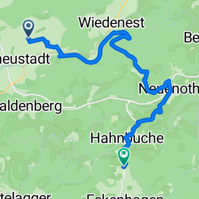
Panoramasteig Etappe 08
A cycling route starting in Bergneustadt, North Rhine-Westphalia, Germany.
Overview
About this route
Offizieller Panoramasteig des Bergischen Wanderlandes
- -:--
- Duration
- 21.8 km
- Distance
- 705 m
- Ascent
- 675 m
- Descent
- ---
- Avg. speed
- ---
- Avg. speed
Route quality
Waytypes & surfaces along the route
Waytypes
Track
15.6 km
(72 %)
Quiet road
3.1 km
(14 %)
Surfaces
Paved
2.7 km
(12 %)
Unpaved
14.4 km
(66 %)
Gravel
8.8 km
(40 %)
Unpaved (undefined)
3.4 km
(16 %)
Continue with Bikemap
Use, edit, or download this cycling route
You would like to ride Panoramasteig Etappe 08 or customize it for your own trip? Here is what you can do with this Bikemap route:
Free features
- Save this route as favorite or in collections
- Copy & plan your own version of this route
- Sync your route with Garmin or Wahoo
Premium features
Free trial for 3 days, or one-time payment. More about Bikemap Premium.
- Navigate this route on iOS & Android
- Export a GPX / KML file of this route
- Create your custom printout (try it for free)
- Download this route for offline navigation
Discover more Premium features.
Get Bikemap PremiumFrom our community
Other popular routes starting in Bergneustadt
- Aggertalsperre
- Distance
- 9.6 km
- Ascent
- 209 m
- Descent
- 227 m
- Location
- Bergneustadt, North Rhine-Westphalia, Germany
- Pieper-Keller-Straße 1, Bergneustadt nach Dieringhauser Straße, Gummersbach
- Distance
- 14.3 km
- Ascent
- 17 m
- Descent
- 170 m
- Location
- Bergneustadt, North Rhine-Westphalia, Germany
- Feldstraße, Bergneustadt nach Breiter Weg, Bergneustadt
- Distance
- 41.6 km
- Ascent
- 580 m
- Descent
- 568 m
- Location
- Bergneustadt, North Rhine-Westphalia, Germany
- Recovered Route
- Distance
- 11 km
- Ascent
- 126 m
- Descent
- 125 m
- Location
- Bergneustadt, North Rhine-Westphalia, Germany
- Bergneustadt nach Am Schaumburger Hof 1, Bonn
- Distance
- 80.8 km
- Ascent
- 599 m
- Descent
- 822 m
- Location
- Bergneustadt, North Rhine-Westphalia, Germany
- Henneweide 6, Bergneustadt nach Am Stadtwald 34, Bergneustadt
- Distance
- 19.8 km
- Ascent
- 309 m
- Descent
- 310 m
- Location
- Bergneustadt, North Rhine-Westphalia, Germany
- Bergneustadt nach Wenden
- Distance
- 68.7 km
- Ascent
- 1,337 m
- Descent
- 1,248 m
- Location
- Bergneustadt, North Rhine-Westphalia, Germany
- Runde um Eckenhagen
- Distance
- 15.7 km
- Ascent
- 372 m
- Descent
- 375 m
- Location
- Bergneustadt, North Rhine-Westphalia, Germany
Open it in the app