

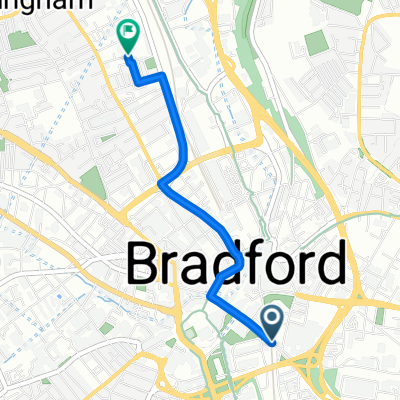
Bradford Pudsey Tong route
A cycling route starting in Bradford, England, United Kingdom.
Overview
About this route
- 1 h 22 min
- Duration
- 16.4 km
- Distance
- 172 m
- Ascent
- 166 m
- Descent
- 12 km/h
- Avg. speed
- ---
- Max. altitude

Route photos


Continue with Bikemap
Use, edit, or download this cycling route
You would like to ride Bradford Pudsey Tong route or customize it for your own trip? Here is what you can do with this Bikemap route:
Free features
- Save this route as favorite or in collections
- Copy & plan your own version of this route
- Sync your route with Garmin or Wahoo
Premium features
Free trial for 3 days, or one-time payment. More about Bikemap Premium.
- Navigate this route on iOS & Android
- Export a GPX / KML file of this route
- Create your custom printout (try it for free)
- Download this route for offline navigation
Discover more Premium features.
Get Bikemap PremiumFrom our community
Other popular routes starting in Bradford
 Bradford Pudsey Tong route
- Distance
- 16.4 km
- Ascent
- 172 m
- Descent
- 166 m
- Location
- Bradford, England, United Kingdom
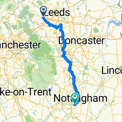 first leg to London
- Distance
- 155.7 km
- Ascent
- 1,362 m
- Descent
- 1,538 m
- Location
- Bradford, England, United Kingdom
 Route 2
- Distance
- 25.4 km
- Ascent
- 328 m
- Descent
- 393 m
- Location
- Bradford, England, United Kingdom
 Bradford City FC to Bradford Interchange
- Distance
- 1.9 km
- Ascent
- 17 m
- Descent
- 30 m
- Location
- Bradford, England, United Kingdom
 Route 1
- Distance
- 16 km
- Ascent
- 187 m
- Descent
- 240 m
- Location
- Bradford, England, United Kingdom
 Tour de Yorkshire 2017 (2.1) Stage 3
- Distance
- 203.9 km
- Ascent
- 1,640 m
- Descent
- 1,593 m
- Location
- Bradford, England, United Kingdom
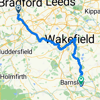 Pearson Road, Bradford to Wombwell Lane, Barnsley
- Distance
- 53.8 km
- Ascent
- 483 m
- Descent
- 642 m
- Location
- Bradford, England, United Kingdom
 Bradford Interchange to Bradford City FC
- Distance
- 2 km
- Ascent
- 48 m
- Descent
- 38 m
- Location
- Bradford, England, United Kingdom
Open it in the app