

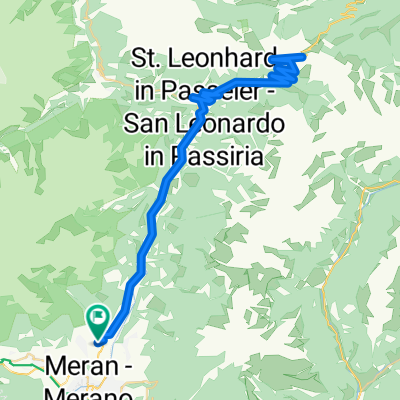
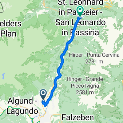
Tirolo - Naturns
A cycling route starting in Caines, Trentino-Alto Adige, Italy.
Overview
About this route
- 1 h 9 min
- Duration
- 17.4 km
- Distance
- 516 m
- Ascent
- 449 m
- Descent
- 15.1 km/h
- Avg. speed
- ---
- Max. altitude

Route quality
Waytypes & surfaces along the route
Waytypes
Cycleway
5.7 km
(33 %)
Quiet road
5.2 km
(30 %)
Surfaces
Paved
14.8 km
(85 %)
Unpaved
0.1 km
(<1 %)
Asphalt
14.7 km
(84 %)
Wood
0.1 km
(<1 %)
Continue with Bikemap
Use, edit, or download this cycling route
You would like to ride Tirolo - Naturns or customize it for your own trip? Here is what you can do with this Bikemap route:
Free features
- Save this route as favorite or in collections
- Copy & plan your own version of this route
- Sync your route with Garmin or Wahoo
Premium features
Free trial for 3 days, or one-time payment. More about Bikemap Premium.
- Navigate this route on iOS & Android
- Export a GPX / KML file of this route
- Create your custom printout (try it for free)
- Download this route for offline navigation
Discover more Premium features.
Get Bikemap PremiumFrom our community
Other popular routes starting in Caines
 girettino1
- Distance
- 10.4 km
- Ascent
- 898 m
- Descent
- 358 m
- Location
- Caines, Trentino-Alto Adige, Italy
 Dorf Tirol - Jaufenpass und zurück
- Distance
- 74.1 km
- Ascent
- 1,710 m
- Descent
- 1,710 m
- Location
- Caines, Trentino-Alto Adige, Italy
 Jaufenstraße nach Bozen
- Distance
- 36.1 km
- Ascent
- 105 m
- Descent
- 274 m
- Location
- Caines, Trentino-Alto Adige, Italy
 Dorf Tirol - Jaufenpass und zurück
- Distance
- 74 km
- Ascent
- 2,378 m
- Descent
- 2,407 m
- Location
- Caines, Trentino-Alto Adige, Italy
 Tirolo - Naturns
- Distance
- 17.4 km
- Ascent
- 516 m
- Descent
- 449 m
- Location
- Caines, Trentino-Alto Adige, Italy
 Merano-Vilpiano
- Distance
- 19 km
- Ascent
- 17 m
- Descent
- 229 m
- Location
- Caines, Trentino-Alto Adige, Italy
 Lingweg, Tirol nach Andreas-Hofer-Straße, St. Leonhard in Passeier
- Distance
- 18.7 km
- Ascent
- 397 m
- Descent
- 249 m
- Location
- Caines, Trentino-Alto Adige, Italy
 Aichweg nach Aichweg
- Distance
- 96.6 km
- Ascent
- 599 m
- Descent
- 601 m
- Location
- Caines, Trentino-Alto Adige, Italy
Open it in the app