

송탄동 307−7, 평택시 to 송탄동 307−7, 평택시
A cycling route starting in Osan, Gyeonggi-do, South Korea.
Overview
About this route
- 13 h 14 min
- Duration
- 23 km
- Distance
- 236 m
- Ascent
- 250 m
- Descent
- 1.7 km/h
- Avg. speed
- ---
- Max. altitude

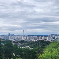
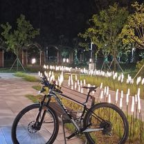
Route photos


Continue with Bikemap
Use, edit, or download this cycling route
You would like to ride 송탄동 307−7, 평택시 to 송탄동 307−7, 평택시 or customize it for your own trip? Here is what you can do with this Bikemap route:
Free features
- Save this route as favorite or in collections
- Copy & plan your own version of this route
- Sync your route with Garmin or Wahoo
Premium features
Free trial for 3 days, or one-time payment. More about Bikemap Premium.
- Navigate this route on iOS & Android
- Export a GPX / KML file of this route
- Create your custom printout (try it for free)
- Download this route for offline navigation
Discover more Premium features.
Get Bikemap PremiumFrom our community
Other popular routes starting in Osan
 with chanhoo
- Distance
- 57.5 km
- Ascent
- 308 m
- Descent
- 360 m
- Location
- Osan, Gyeonggi-do, South Korea
 From Songtan to the lake and back.
- Distance
- 32.5 km
- Ascent
- 60 m
- Descent
- 60 m
- Location
- Osan, Gyeonggi-do, South Korea
 함정카드ㄷㄷㄷㄷ
- Distance
- 18.2 km
- Ascent
- 246 m
- Descent
- 255 m
- Location
- Osan, Gyeonggi-do, South Korea
 동탄면 5−1, 화성시 to 동탄면 4−5, 화성시
- Distance
- 16.2 km
- Ascent
- 185 m
- Descent
- 127 m
- Location
- Osan, Gyeonggi-do, South Korea
 오산동 ~ 오산동
- Distance
- 42.7 km
- Ascent
- 259 m
- Descent
- 284 m
- Location
- Osan, Gyeonggi-do, South Korea
 393-20 393-20 ~ 오산동
- Distance
- 29.7 km
- Ascent
- 176 m
- Descent
- 153 m
- Location
- Osan, Gyeonggi-do, South Korea
 반송동 135-3, 화성시 ~ 반송동, 화성시
- Distance
- 18.8 km
- Ascent
- 117 m
- Descent
- 88 m
- Location
- Osan, Gyeonggi-do, South Korea
 Route to 동탄면 4−6, 화성시
- Distance
- 7.8 km
- Ascent
- 55 m
- Descent
- 34 m
- Location
- Osan, Gyeonggi-do, South Korea
Open it in the app