

De Monterrey 2801, Conchalí a Nahuelbuta 1421, Conchalí
A cycling route starting in Lo Prado, Santiago Metropolitan, Chile.
Overview
About this route
- 2 h 48 min
- Duration
- 28.3 km
- Distance
- 736 m
- Ascent
- 751 m
- Descent
- 10.1 km/h
- Avg. speed
- ---
- Max. altitude

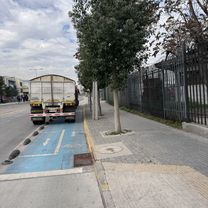
Route photos


Continue with Bikemap
Use, edit, or download this cycling route
You would like to ride De Monterrey 2801, Conchalí a Nahuelbuta 1421, Conchalí or customize it for your own trip? Here is what you can do with this Bikemap route:
Free features
- Save this route as favorite or in collections
- Copy & plan your own version of this route
- Sync your route with Garmin or Wahoo
Premium features
Free trial for 3 days, or one-time payment. More about Bikemap Premium.
- Navigate this route on iOS & Android
- Export a GPX / KML file of this route
- Create your custom printout (try it for free)
- Download this route for offline navigation
Discover more Premium features.
Get Bikemap PremiumFrom our community
Other popular routes starting in Lo Prado
 Ruta desde Calle Titán
- Distance
- 14.3 km
- Ascent
- 229 m
- Descent
- 115 m
- Location
- Lo Prado, Santiago Metropolitan, Chile
 Ruta desde Río Maule
- Distance
- 18.2 km
- Ascent
- 438 m
- Descent
- 442 m
- Location
- Lo Prado, Santiago Metropolitan, Chile
 ruta hacia Laguna Piedra Roja
- Distance
- 40.1 km
- Ascent
- 538 m
- Descent
- 525 m
- Location
- Lo Prado, Santiago Metropolitan, Chile
 De PI1656-Avenida Aeropuerto / Esq. Av. A. Vespucio, Cerrillos a Poiguano 10925, La Pintana
- Distance
- 13.8 km
- Ascent
- 314 m
- Descent
- 218 m
- Location
- Lo Prado, Santiago Metropolitan, Chile
 Avenida Las Torres, Quilicura a Avenida Chesterton, Las Condes
- Distance
- 25.3 km
- Ascent
- 296 m
- Descent
- 81 m
- Location
- Lo Prado, Santiago Metropolitan, Chile
 De Comandante Chacón 6174, Santiago a Comandante Chacón 6168, Santiago
- Distance
- 13.1 km
- Ascent
- 179 m
- Descent
- 198 m
- Location
- Lo Prado, Santiago Metropolitan, Chile
 aburrimiento
- Distance
- 13 km
- Ascent
- 109 m
- Descent
- 112 m
- Location
- Lo Prado, Santiago Metropolitan, Chile
 subida 42k
- Distance
- 20.4 km
- Ascent
- 302 m
- Descent
- 115 m
- Location
- Lo Prado, Santiago Metropolitan, Chile
Open it in the app