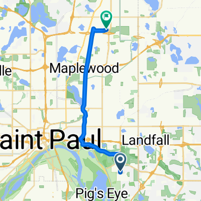
B2B00211 55119>55101 via Upper Afton, 7th Street
- 17.8 km
- 189 m
- 192 m
- Maplewood, Minnesota, United States
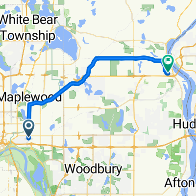
Take Upper Afton west to Ruth. Turn right and follow Ruth to Minnehaha. Turn left at Minnehaha and continue to Johnson Pkwy. Turn right at Johnson Parkway and continue to Lake Phalen. Veer to the left on to Wheelock Pkwy. Continue on Wheelock Pkwy across Hwy. 61 and on to Edgerton Street. Turn right at Edgerton. Follow Edgerton north past Larpenteur and over Highway 36. Past Gervais Lake on your right and over 694 to Vadnais Lake Blvd. Turn left and follow Vadnais Lake Blvd. around the lake until you come to Rice Street. Turn right at Rice Street and continue north on Rice to Gramsie Rd. At the top of the big hill turn right at Victoria. Take Victoria to County Rd. F and turn left. Follow Cty. F to Lexington and turn left. Go south on Lexington to 4001 and your destination.
Road
17.6 km65 %Cycleway
3.8 km14 %Paved
11.7 km(43 %)Asphalt
10.6 km39 %Concrete
1.1 km4 %Undefined
15.5 km57 %You can take the road through the lake at this point to County Rd. F and then left to Gramsie and Rice. THe gate is not open during the late fall and winter.
Free trial for 3 days, or one-time payment. More about Bikemap Premium.
Discover more Premium features.
Get Bikemap PremiumOpen it in the app