R09 Montaud-St Hippolyte-Pompignan
A cycling route starting in Saint-Drézéry, Occitanie, France.
Overview
About this route
La piste cyclable entre Quissac et St Hippolyte est maintenant goudronée et ouverte. Très bonne route.
- -:--
- Duration
- 71.8 km
- Distance
- 496 m
- Ascent
- 487 m
- Descent
- ---
- Avg. speed
- ---
- Max. altitude
Route quality
Waytypes & surfaces along the route
Waytypes
Busy road
26 km
(36 %)
Road
22.4 km
(31 %)
Surfaces
Paved
32.2 km
(45 %)
Unpaved
0.2 km
(<1 %)
Asphalt
31.8 km
(44 %)
Paved (undefined)
0.3 km
(<1 %)
Continue with Bikemap
Use, edit, or download this cycling route
You would like to ride R09 Montaud-St Hippolyte-Pompignan or customize it for your own trip? Here is what you can do with this Bikemap route:
Free features
- Save this route as favorite or in collections
- Copy & plan your own version of this route
- Sync your route with Garmin or Wahoo
Premium features
Free trial for 3 days, or one-time payment. More about Bikemap Premium.
- Navigate this route on iOS & Android
- Export a GPX / KML file of this route
- Create your custom printout (try it for free)
- Download this route for offline navigation
Discover more Premium features.
Get Bikemap PremiumFrom our community
Other popular routes starting in Saint-Drézéry
- st mathieu st martin issensac le pic 90KM
- Distance
- 91.3 km
- Ascent
- 830 m
- Descent
- 824 m
- Location
- Saint-Drézéry, Occitanie, France
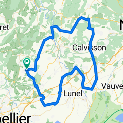
- voie verte calvisson
- Distance
- 82.8 km
- Ascent
- 302 m
- Descent
- 308 m
- Location
- Saint-Drézéry, Occitanie, France
- MTB 01. Lac Cécéles 29 km easy
- Distance
- 27 km
- Ascent
- 290 m
- Descent
- 294 m
- Location
- Saint-Drézéry, Occitanie, France
- clarensac st genies cannes et clairan
- Distance
- 96.3 km
- Ascent
- 541 m
- Descent
- 541 m
- Location
- Saint-Drézéry, Occitanie, France
- 97km asperes logrian durfort monoblet st hyppolyte
- Distance
- 97.5 km
- Ascent
- 720 m
- Descent
- 718 m
- Location
- Saint-Drézéry, Occitanie, France
- 95 1300 lauret pompignan saint martin cazevieille
- Distance
- 94.8 km
- Ascent
- 588 m
- Descent
- 588 m
- Location
- Saint-Drézéry, Occitanie, France
- voie verte grande motte murviel
- Distance
- 101.1 km
- Ascent
- 670 m
- Descent
- 662 m
- Location
- Saint-Drézéry, Occitanie, France
- 98km sommieres fons montagnacbragassargueslauret
- Distance
- 97.5 km
- Ascent
- 425 m
- Descent
- 431 m
- Location
- Saint-Drézéry, Occitanie, France
Open it in the app