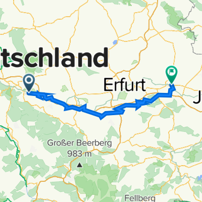
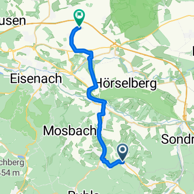
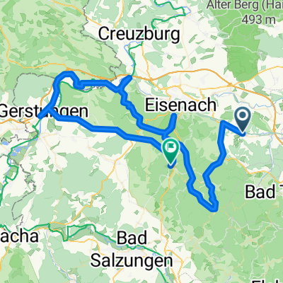
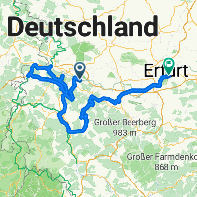
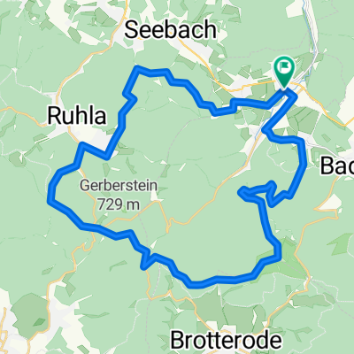
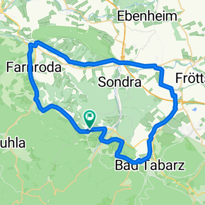
Wutha - Rennsteig - Hörsel - Wilhelmsthal
A cycling route starting in Seebach, Free State of Thuringia, Germany.
Overview
About this route
Von Wutha über Ruhla zum Rennsteig rauf und weiter zur "Wilden Sau" um einen Abstecher zur Wartburg zu machen. Danach ging es wieder über den Rennsteig nach Hörsel an der Werra. Hier an der Werra lang bis nach Gerstungen und dann über Förtha nach Wilhelmsthal.
- -:--
- Duration
- 87.8 km
- Distance
- 1,259 m
- Ascent
- 1,257 m
- Descent
- ---
- Avg. speed
- 700 m
- Max. altitude
Route quality
Waytypes & surfaces along the route
Waytypes
Track
30.7 km
(35 %)
Busy road
27.2 km
(31 %)
Surfaces
Paved
40.5 km
(46 %)
Unpaved
27.6 km
(31 %)
Asphalt
35.6 km
(41 %)
Gravel
21.4 km
(24 %)
Continue with Bikemap
Use, edit, or download this cycling route
You would like to ride Wutha - Rennsteig - Hörsel - Wilhelmsthal or customize it for your own trip? Here is what you can do with this Bikemap route:
Free features
- Save this route as favorite or in collections
- Copy & plan your own version of this route
- Split it into stages to create a multi-day tour
- Sync your route with Garmin or Wahoo
Premium features
Free trial for 3 days, or one-time payment. More about Bikemap Premium.
- Navigate this route on iOS & Android
- Export a GPX / KML file of this route
- Create your custom printout (try it for free)
- Download this route for offline navigation
Discover more Premium features.
Get Bikemap PremiumFrom our community
Other popular routes starting in Seebach
- Westlicher Thüringer Wald
- Distance
- 208.2 km
- Ascent
- 1,533 m
- Descent
- 1,563 m
- Location
- Seebach, Free State of Thuringia, Germany
- Hörselbergrunde
- Distance
- 36.3 km
- Ascent
- 287 m
- Descent
- 300 m
- Location
- Seebach, Free State of Thuringia, Germany
- Entspannende Route in Hörselberg-Hainich
- Distance
- 5.5 km
- Ascent
- 176 m
- Descent
- 79 m
- Location
- Seebach, Free State of Thuringia, Germany
- Hopfenrain - ESA Markt
- Distance
- 11.4 km
- Ascent
- 67 m
- Descent
- 193 m
- Location
- Seebach, Free State of Thuringia, Germany
- Friedrich-Engels-Ring 48, Seebach do Friedrich-Engels-Ring 42, Seebach
- Distance
- 112.3 km
- Ascent
- 261 m
- Descent
- 490 m
- Location
- Seebach, Free State of Thuringia, Germany
- Erkundung - Cappuccino 2018
- Distance
- 39.3 km
- Ascent
- 485 m
- Descent
- 485 m
- Location
- Seebach, Free State of Thuringia, Germany
- Schwarzhausen - Ruhla - Beerberg - Inselsberg - Fischbach
- Distance
- 32.3 km
- Ascent
- 961 m
- Descent
- 961 m
- Location
- Seebach, Free State of Thuringia, Germany
- 14.05.10 Eisenach-Weimar
- Distance
- 110.5 km
- Ascent
- 1,086 m
- Descent
- 1,120 m
- Location
- Seebach, Free State of Thuringia, Germany
Open it in the app