

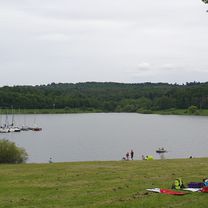
Zur Äpplerhöhe mit Blick auf die Münzenburg
A cycling route starting in Friedberg, Hesse, Germany.
Overview
About this route
Überwiegend alphaltierte oder betonierte Feldwege
Angenehme Strecke auch für Anfänger geeignet
Nur eine Steigung nach den Römerhöfen ist etwas anspruchsvoller.
- -:--
- Duration
- 30.3 km
- Distance
- 171 m
- Ascent
- 171 m
- Descent
- ---
- Avg. speed
- ---
- Max. altitude
Route quality
Waytypes & surfaces along the route
Waytypes
Track
17.7 km
(58 %)
Quiet road
3.5 km
(12 %)
Surfaces
Paved
23.7 km
(78 %)
Unpaved
4.2 km
(14 %)
Asphalt
16.9 km
(56 %)
Paved (undefined)
4 km
(13 %)
Continue with Bikemap
Use, edit, or download this cycling route
You would like to ride Zur Äpplerhöhe mit Blick auf die Münzenburg or customize it for your own trip? Here is what you can do with this Bikemap route:
Free features
- Save this route as favorite or in collections
- Copy & plan your own version of this route
- Sync your route with Garmin or Wahoo
Premium features
Free trial for 3 days, or one-time payment. More about Bikemap Premium.
- Navigate this route on iOS & Android
- Export a GPX / KML file of this route
- Create your custom printout (try it for free)
- Download this route for offline navigation
Discover more Premium features.
Get Bikemap PremiumFrom our community
Other popular routes starting in Friedberg
 Saalburg und Winterstein ab Friedberg (Hs.)
- Distance
- 48.3 km
- Ascent
- 724 m
- Descent
- 724 m
- Location
- Friedberg, Hesse, Germany
 Friedberg - Seligenstadt
- Distance
- 65.9 km
- Ascent
- 102 m
- Descent
- 157 m
- Location
- Friedberg, Hesse, Germany
 Wintersteinrunde
- Distance
- 20.4 km
- Ascent
- 554 m
- Descent
- 336 m
- Location
- Friedberg, Hesse, Germany
 Blofeld
- Distance
- 40.4 km
- Ascent
- 114 m
- Descent
- 114 m
- Location
- Friedberg, Hesse, Germany
 Friedberg Rundweg
- Distance
- 37.4 km
- Ascent
- 217 m
- Descent
- 222 m
- Location
- Friedberg, Hesse, Germany
 Friedberg - Niddastausee
- Distance
- 40.1 km
- Ascent
- 213 m
- Descent
- 104 m
- Location
- Friedberg, Hesse, Germany
 Feierabend Tour
- Distance
- 25.3 km
- Ascent
- 612 m
- Descent
- 649 m
- Location
- Friedberg, Hesse, Germany
 Halfpipe ( Feldi und Hoherodskopf )
- Distance
- 201 km
- Ascent
- 1,410 m
- Descent
- 1,410 m
- Location
- Friedberg, Hesse, Germany
Open it in the app