

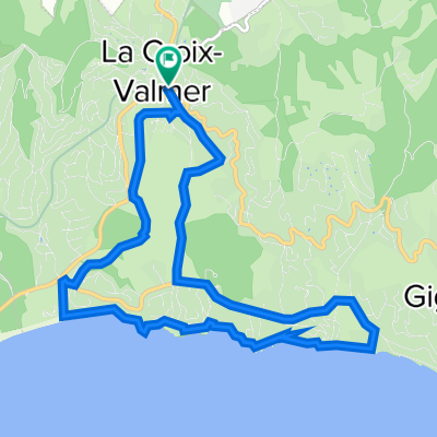
1. Cote dAzur Tour 2008
A cycling route starting in La Croix-Valmer, Provence-Alpes-Côte d'Azur Region, France.
Overview
About this route
durch die schönen Berge der Cote d Azur
- -:--
- Duration
- 213.7 km
- Distance
- 4,647 m
- Ascent
- 4,648 m
- Descent
- ---
- Avg. speed
- 553 m
- Max. altitude

Route quality
Waytypes & surfaces along the route
Waytypes
Busy road
134.2 km
(63 %)
Road
62.2 km
(29 %)
Surfaces
Paved
198.9 km
(93 %)
Asphalt
198.9 km
(93 %)
Undefined
14.9 km
(7 %)
Continue with Bikemap
Use, edit, or download this cycling route
You would like to ride 1. Cote dAzur Tour 2008 or customize it for your own trip? Here is what you can do with this Bikemap route:
Free features
- Save this route as favorite or in collections
- Copy & plan your own version of this route
- Split it into stages to create a multi-day tour
- Sync your route with Garmin or Wahoo
Premium features
Free trial for 3 days, or one-time payment. More about Bikemap Premium.
- Navigate this route on iOS & Android
- Export a GPX / KML file of this route
- Create your custom printout (try it for free)
- Download this route for offline navigation
Discover more Premium features.
Get Bikemap PremiumFrom our community
Other popular routes starting in La Croix-Valmer
 Gigaro
- Distance
- 12.2 km
- Ascent
- 205 m
- Descent
- 203 m
- Location
- La Croix-Valmer, Provence-Alpes-Côte d'Azur Region, France
 Croix-Valmer - S:t Tropez ToR
- Distance
- 38 km
- Ascent
- 471 m
- Descent
- 475 m
- Location
- La Croix-Valmer, Provence-Alpes-Côte d'Azur Region, France
 Circuit bord de mer La Croix Valmer- Le Lavandou
- Distance
- 41.7 km
- Ascent
- 573 m
- Descent
- 570 m
- Location
- La Croix-Valmer, Provence-Alpes-Côte d'Azur Region, France
 1. Cote dAzur Tour 2008
- Distance
- 213.7 km
- Ascent
- 4,647 m
- Descent
- 4,648 m
- Location
- La Croix-Valmer, Provence-Alpes-Côte d'Azur Region, France
 Von La Croix Valmer nach Sanary- sur- Mer
- Distance
- 81.5 km
- Ascent
- 341 m
- Descent
- 338 m
- Location
- La Croix-Valmer, Provence-Alpes-Côte d'Azur Region, France
 No cars
- Distance
- 30.9 km
- Ascent
- 197 m
- Descent
- 300 m
- Location
- La Croix-Valmer, Provence-Alpes-Côte d'Azur Region, France
 Rivages
- Distance
- 10.6 km
- Ascent
- 161 m
- Descent
- 162 m
- Location
- La Croix-Valmer, Provence-Alpes-Côte d'Azur Region, France
 Cavalaire vs. Cap Taillat Wanderweg
- Distance
- 12 km
- Ascent
- 282 m
- Descent
- 283 m
- Location
- La Croix-Valmer, Provence-Alpes-Côte d'Azur Region, France
Open it in the app