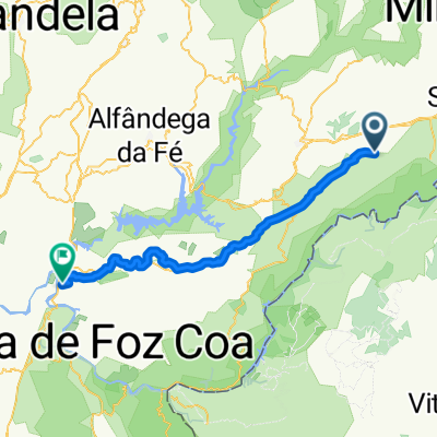
13-17_N222 e local+ESTE em Portugal
A cycling route starting in Mogadouro, Braganza District, Portugal.
Overview
About this route
Com 50Kg de autonomia :)
- -:--
- Duration
- 67.9 km
- Distance
- 1,188 m
- Ascent
- 1,503 m
- Descent
- ---
- Avg. speed
- ---
- Avg. speed
Route quality
Waytypes & surfaces along the route
Waytypes
Busy road
25.6 km
(38 %)
Quiet road
20.6 km
(30 %)
Surfaces
Paved
10.1 km
(15 %)
Unpaved
14.9 km
(22 %)
Gravel
13.4 km
(20 %)
Asphalt
8.6 km
(13 %)
Continue with Bikemap
Use, edit, or download this cycling route
You would like to ride 13-17_N222 e local+ESTE em Portugal or customize it for your own trip? Here is what you can do with this Bikemap route:
Free features
- Save this route as favorite or in collections
- Copy & plan your own version of this route
- Sync your route with Garmin or Wahoo
Premium features
Free trial for 3 days, or one-time payment. More about Bikemap Premium.
- Navigate this route on iOS & Android
- Export a GPX / KML file of this route
- Create your custom printout (try it for free)
- Download this route for offline navigation
Discover more Premium features.
Get Bikemap PremiumFrom our community
Other popular routes starting in Mogadouro
- portugal day 2
- Distance
- 125.3 km
- Ascent
- 1,796 m
- Descent
- 1,768 m
- Location
- Mogadouro, Braganza District, Portugal
- 9ème étape Bemposta/Vilanova Foz Coa
- Distance
- 75.8 km
- Ascent
- 697 m
- Descent
- 1,242 m
- Location
- Mogadouro, Braganza District, Portugal
- trail serras figueira e zava
- Distance
- 12.1 km
- Ascent
- 441 m
- Descent
- 442 m
- Location
- Mogadouro, Braganza District, Portugal
- Arribes_Duero_Etapa03
- Distance
- 141.7 km
- Ascent
- 2,776 m
- Descent
- 2,872 m
- Location
- Mogadouro, Braganza District, Portugal
- Tour 4 Vuelta 2012
- Distance
- 157 km
- Ascent
- 1,330 m
- Descent
- 1,999 m
- Location
- Mogadouro, Braganza District, Portugal
- mogadouro to fermoselle
- Distance
- 40.8 km
- Ascent
- 573 m
- Descent
- 584 m
- Location
- Mogadouro, Braganza District, Portugal
- GR36 #2
- Distance
- 58.9 km
- Ascent
- 1,157 m
- Descent
- 1,339 m
- Location
- Mogadouro, Braganza District, Portugal
- Trail - serras de figueira e zava
- Distance
- 12.1 km
- Ascent
- 436 m
- Descent
- 437 m
- Location
- Mogadouro, Braganza District, Portugal
Open it in the app