

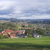
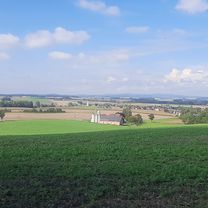
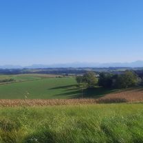
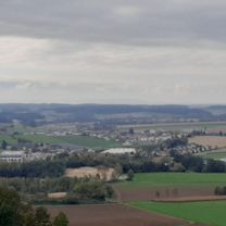
Bad Schallerbach Bhf R17 Rad-Vital entl. d. Polsenz
A cycling route starting in Bad Schallerbach, Upper Austria, Austria.
Overview
About this route
- 1 h 14 min
- Duration
- 27.9 km
- Distance
- 590 m
- Ascent
- 597 m
- Descent
- 22.5 km/h
- Avg. speed
- ---
- Max. altitude

Route quality
Waytypes & surfaces along the route
Waytypes
Quiet road
9.5 km
(34 %)
Road
3.1 km
(11 %)
Surfaces
Paved
11.4 km
(41 %)
Unpaved
2.5 km
(9 %)
Asphalt
11.4 km
(41 %)
Gravel
0.8 km
(3 %)
Continue with Bikemap
Use, edit, or download this cycling route
You would like to ride Bad Schallerbach Bhf R17 Rad-Vital entl. d. Polsenz or customize it for your own trip? Here is what you can do with this Bikemap route:
Free features
- Save this route as favorite or in collections
- Copy & plan your own version of this route
- Sync your route with Garmin or Wahoo
Premium features
Free trial for 3 days, or one-time payment. More about Bikemap Premium.
- Navigate this route on iOS & Android
- Export a GPX / KML file of this route
- Create your custom printout (try it for free)
- Download this route for offline navigation
Discover more Premium features.
Get Bikemap PremiumFrom our community
Other popular routes starting in Bad Schallerbach
 Pauliberg, Römerstrasse, bauregger
- Distance
- 6.3 km
- Ascent
- 180 m
- Descent
- 242 m
- Location
- Bad Schallerbach, Upper Austria, Austria
 buchkirchen, mistlbach, axberg, polsing, scharten
- Distance
- 41.4 km
- Ascent
- 550 m
- Descent
- 569 m
- Location
- Bad Schallerbach, Upper Austria, Austria
 pöttting, waizenkirchen, sommersberg
- Distance
- 51.4 km
- Ascent
- 481 m
- Descent
- 529 m
- Location
- Bad Schallerbach, Upper Austria, Austria
 fraham, Donau, hinzenbach
- Distance
- 41.5 km
- Ascent
- 118 m
- Descent
- 130 m
- Location
- Bad Schallerbach, Upper Austria, Austria
 grieskirchen, St.Georgen, meggenhofen, gallspach, dingbach
- Distance
- 44.1 km
- Ascent
- 351 m
- Descent
- 401 m
- Location
- Bad Schallerbach, Upper Austria, Austria
 stroheim
- Distance
- 40.2 km
- Ascent
- 547 m
- Descent
- 607 m
- Location
- Bad Schallerbach, Upper Austria, Austria
 scharten Runde
- Distance
- 30.1 km
- Ascent
- 244 m
- Descent
- 297 m
- Location
- Bad Schallerbach, Upper Austria, Austria
 puchberg, fernreith, gferet, müllerberg
- Distance
- 34.5 km
- Ascent
- 361 m
- Descent
- 426 m
- Location
- Bad Schallerbach, Upper Austria, Austria
Open it in the app