
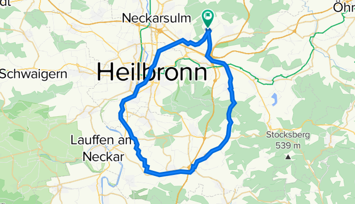
Gellmersbach-Schozachtal-Heilbronn-Gellmersbach
A cycling route starting in Eberstadt, Baden-Wurttemberg, Germany.
Overview
About this route
- -:--
- Duration
- 46.3 km
- Distance
- 270 m
- Ascent
- 269 m
- Descent
- ---
- Avg. speed
- ---
- Max. altitude

Route quality
Waytypes & surfaces along the route
Waytypes
Path
17.1 km
(37 %)
Track
11.6 km
(25 %)
Surfaces
Paved
35.7 km
(77 %)
Unpaved
7.4 km
(16 %)
Asphalt
35.2 km
(76 %)
Loose gravel
6.5 km
(14 %)
Continue with Bikemap
Use, edit, or download this cycling route
You would like to ride Gellmersbach-Schozachtal-Heilbronn-Gellmersbach or customize it for your own trip? Here is what you can do with this Bikemap route:
Free features
- Save this route as favorite or in collections
- Copy & plan your own version of this route
- Sync your route with Garmin or Wahoo
Premium features
Free trial for 3 days, or one-time payment. More about Bikemap Premium.
- Navigate this route on iOS & Android
- Export a GPX / KML file of this route
- Create your custom printout (try it for free)
- Download this route for offline navigation
Discover more Premium features.
Get Bikemap PremiumFrom our community
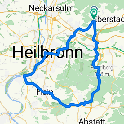
Other popular routes starting in Eberstadt
 06.01.2020
- Distance
- 20.2 km
- Ascent
- 307 m
- Descent
- 307 m
- Location
- Eberstadt, Baden-Wurttemberg, Germany
 Besenwanderung "Besen Busch"
- Distance
- 2.1 km
- Ascent
- 44 m
- Descent
- 74 m
- Location
- Eberstadt, Baden-Wurttemberg, Germany
 Waldenburg-Dahenfeld
- Distance
- 88.1 km
- Ascent
- 1,120 m
- Descent
- 1,167 m
- Location
- Eberstadt, Baden-Wurttemberg, Germany
 Gellmersbach-Schozachtal-Heilbronn-Gellmersbach
- Distance
- 46.3 km
- Ascent
- 270 m
- Descent
- 269 m
- Location
- Eberstadt, Baden-Wurttemberg, Germany
 RC-Pfeil-Marathon 2007 (ungefährer Verlauf)
- Distance
- 28.4 km
- Ascent
- 537 m
- Descent
- 537 m
- Location
- Eberstadt, Baden-Wurttemberg, Germany
 Route 2
- Distance
- 33.9 km
- Ascent
- 278 m
- Descent
- 282 m
- Location
- Eberstadt, Baden-Wurttemberg, Germany
 Ensommertraining 21-09-2010
- Distance
- 46.8 km
- Ascent
- 407 m
- Descent
- 406 m
- Location
- Eberstadt, Baden-Wurttemberg, Germany
 Sonntagstour 08.03.2020
- Distance
- 38 km
- Ascent
- 449 m
- Descent
- 446 m
- Location
- Eberstadt, Baden-Wurttemberg, Germany
Open it in the app