

Mulderadweg - Abschnitt Penig bis Rochlitz (Zwickauer Mulde)
A cycling route starting in Penig, Saxony, Germany.
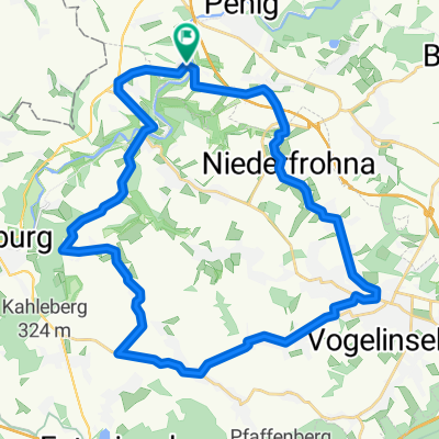
Overview
About this route
Dies ist der vierte Abschnitt an der Zwickauer Mulde mit einer Gesamtlänge von 44,7 km.
- -:--
- Duration
- 22.4 km
- Distance
- 227 m
- Ascent
- 280 m
- Descent
- ---
- Avg. speed
- ---
- Max. altitude
Route quality
Waytypes & surfaces along the route
Waytypes
Quiet road
9.4 km
(42 %)
Road
5 km
(22 %)
Surfaces
Paved
19.3 km
(86 %)
Unpaved
1.3 km
(6 %)
Asphalt
18.5 km
(83 %)
Gravel
0.8 km
(3 %)
Continue with Bikemap
Use, edit, or download this cycling route
You would like to ride Mulderadweg - Abschnitt Penig bis Rochlitz (Zwickauer Mulde) or customize it for your own trip? Here is what you can do with this Bikemap route:
Free features
- Save this route as favorite or in collections
- Copy & plan your own version of this route
- Sync your route with Garmin or Wahoo
Premium features
Free trial for 3 days, or one-time payment. More about Bikemap Premium.
- Navigate this route on iOS & Android
- Export a GPX / KML file of this route
- Create your custom printout (try it for free)
- Download this route for offline navigation
Discover more Premium features.
Get Bikemap PremiumFrom our community
Other popular routes starting in Penig
 Berg- und Talfahrt rund um Kaufungen
- Distance
- 33 km
- Ascent
- 351 m
- Descent
- 301 m
- Location
- Penig, Saxony, Germany
 Meischnerstraße 13, Penig nach Meischnerstraße 13, Penig
- Distance
- 16.4 km
- Ascent
- 67 m
- Descent
- 126 m
- Location
- Penig, Saxony, Germany
 Penig - Burgstädt - Wechselburg und über Lunzenau zurück
- Distance
- 32.2 km
- Ascent
- 229 m
- Descent
- 316 m
- Location
- Penig, Saxony, Germany
 Waldenburg
- Distance
- 23.8 km
- Ascent
- 251 m
- Descent
- 248 m
- Location
- Penig, Saxony, Germany
 Wälder und Wiesen
- Distance
- 21.4 km
- Ascent
- 250 m
- Descent
- 250 m
- Location
- Penig, Saxony, Germany
 kleine Runde bei Penig
- Distance
- 28.1 km
- Ascent
- 365 m
- Descent
- 377 m
- Location
- Penig, Saxony, Germany
 Waldenburg
- Distance
- 23.8 km
- Ascent
- 259 m
- Descent
- 256 m
- Location
- Penig, Saxony, Germany
 Penig-Kohren
- Distance
- 14.9 km
- Ascent
- 139 m
- Descent
- 149 m
- Location
- Penig, Saxony, Germany
Open it in the app