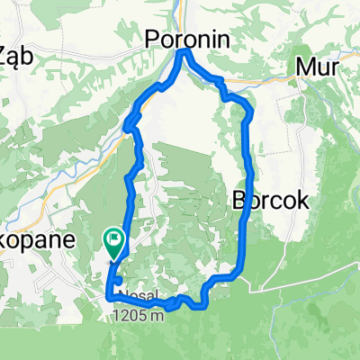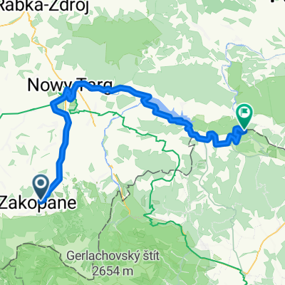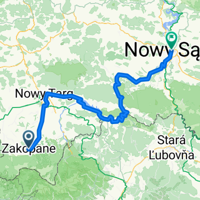
04.10.20 Jaskinia Mylna
- 32.8 km
- 999 m
- 946 m
- Zakopane, Lesser Poland Voivodeship, Poland
A cycling route starting in Zakopane, Lesser Poland Voivodeship, Poland.
Overview
created this 5 years ago


Continue with Bikemap
You would like to ride 04.10.20 Jaskinia Mylna or customize it for your own trip? Here is what you can do with this Bikemap route:
Free trial for 3 days, or one-time payment. More about Bikemap Premium.
Discover more Premium features.
Get Bikemap PremiumFrom our community
Open it in the app