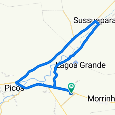
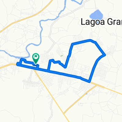
Recovered Route
A cycling route starting in Picos, PiauĂ, Brazil.
Overview
About this route
- 1 h 1 min
- Duration
- 10.5 km
- Distance
- 55 m
- Ascent
- 57 m
- Descent
- 10.3 km/h
- Avg. speed
- ---
- Avg. speed
Continue with Bikemap
Use, edit, or download this cycling route
You would like to ride Recovered Route or customize it for your own trip? Here is what you can do with this Bikemap route:
Free features
- Save this route as favorite or in collections
- Copy & plan your own version of this route
- Sync your route with Garmin or Wahoo
Premium features
Free trial for 3 days, or one-time payment. More about Bikemap Premium.
- Navigate this route on iOS & Android
- Export a GPX / KML file of this route
- Create your custom printout (try it for free)
- Download this route for offline navigation
Discover more Premium features.
Get Bikemap PremiumFrom our community
Other popular routes starting in Picos
- 10K Tranquilo
- Distance
- 10.5 km
- Ascent
- 101 m
- Descent
- 101 m
- Location
- Picos, PiauĂ, Brazil
- De Estrada Sem Nome a Rua AntĂ´nio Claro
- Distance
- 92.6 km
- Ascent
- 693 m
- Descent
- 746 m
- Location
- Picos, PiauĂ, Brazil
- Rua SĂŁo CristĂłvĂŁo, Picos a Rua Frei Ibiapina, 390, Picos
- Distance
- 59.7 km
- Ascent
- 381 m
- Descent
- 378 m
- Location
- Picos, PiauĂ, Brazil
- De Rua AntĂ´nio Claro a Rua AntĂ´nio Claro da Luz
- Distance
- 70.7 km
- Ascent
- 759 m
- Descent
- 758 m
- Location
- Picos, PiauĂ, Brazil
- 7k Easy
- Distance
- 7.1 km
- Ascent
- 17 m
- Descent
- 18 m
- Location
- Picos, PiauĂ, Brazil
- Rua AntĂ´nio Viana, 715, Picos a Rua JosĂŠ Costa, 755, Picos
- Distance
- 33.4 km
- Ascent
- 385 m
- Descent
- 368 m
- Location
- Picos, PiauĂ, Brazil
- Recovered Route
- Distance
- 72.2 km
- Ascent
- 479 m
- Descent
- 486 m
- Location
- Picos, PiauĂ, Brazil
- De Rua AntĂ´nio Claro a WHXF+FQ
- Distance
- 95.3 km
- Ascent
- 964 m
- Descent
- 962 m
- Location
- Picos, PiauĂ, Brazil
Open it in the app