

Guatemala de Palenque à la frontière Honduras
A cycling route starting in Palenque/Temp, Chiapas, Mexico.
Overview
About this route
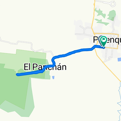
Palenque-border passage through the jungle with a stop in the village of Entre Rios. Continuation of the journey: east of the country: border with Belize up to 'River', crossing it and exiting the country through Chiquimula.
Route to see as there is no existing road on the map!
- -:--
- Duration
- 773.6 km
- Distance
- 2,631 m
- Ascent
- 2,044 m
- Descent
- ---
- Avg. speed
- ---
- Max. altitude

Route highlights
Points of interest along the route
Point of interest after 213.5 km
route ?
Point of interest after 309.6 km
Entre Rios ?
Continue with Bikemap
Use, edit, or download this cycling route
You would like to ride Guatemala de Palenque à la frontière Honduras or customize it for your own trip? Here is what you can do with this Bikemap route:
Free features
- Save this route as favorite or in collections
- Copy & plan your own version of this route
- Split it into stages to create a multi-day tour
- Sync your route with Garmin or Wahoo
Premium features
Free trial for 3 days, or one-time payment. More about Bikemap Premium.
- Navigate this route on iOS & Android
- Export a GPX / KML file of this route
- Create your custom printout (try it for free)
- Download this route for offline navigation
Discover more Premium features.
Get Bikemap PremiumFrom our community
Other popular routes starting in Palenque/Temp
 ruta ruinas
- Distance
- 8.1 km
- Ascent
- 183 m
- Descent
- 124 m
- Location
- Palenque/Temp, Chiapas, Mexico
 Palenque - Welib Ha
- Distance
- 44 km
- Ascent
- 358 m
- Descent
- 302 m
- Location
- Palenque/Temp, Chiapas, Mexico
 7a Oriente Sur, Palenque a San Andrés, Palenque
- Distance
- 13 km
- Ascent
- 172 m
- Descent
- 174 m
- Location
- Palenque/Temp, Chiapas, Mexico
 Prolongación 4a. Poniente Sur, Palenque a Prolongación 4a. Poniente Sur, Palenque
- Distance
- 14.9 km
- Ascent
- 300 m
- Descent
- 274 m
- Location
- Palenque/Temp, Chiapas, Mexico
 Palenque - Welib Ha
- Distance
- 44 km
- Ascent
- 381 m
- Descent
- 335 m
- Location
- Palenque/Temp, Chiapas, Mexico
 2010-03-18 Palenque to El Aguacatal
- Distance
- 109.5 km
- Ascent
- 169 m
- Descent
- 237 m
- Location
- Palenque/Temp, Chiapas, Mexico
 J24 – Mercredi 03 février 2016 – Palenque – Cascadas de Agua Azul
- Distance
- 64 km
- Ascent
- ---
- Descent
- ---
- Location
- Palenque/Temp, Chiapas, Mexico
 Palenque to Chetumal
- Distance
- 478 km
- Ascent
- 465 m
- Descent
- 538 m
- Location
- Palenque/Temp, Chiapas, Mexico
Open it in the app