

Marche Umbria Etappe 6A
A cycling route starting in Norcia, Umbria, Italy.
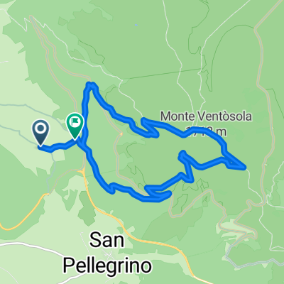
Overview
About this route
Von Norcia durch das Piano Grande, Arquata del Tronto und Amatrice nach Mascioni (Lago Campotosto)
Anmerkungen:
Es ist mir nicht gelungen, diese Etappe in einer Route darzustellen, deshalb die Zweiteilung und verwirrende Streckendarstellung.
Die SP64 ist in Richtung Pescara del Tronto gesperrt. Den Beginn der Sperrung habe ich als POI gekennzeichnet.
Bis zur Straßensperre kann man die SP64 befahren (in Bikemap als "Grande Anello in Bicicletta" bezeichnet). Dazu bin ich bei Km16 in Richtung Pescara del Tronto und nicht in Richtung Castelluccio gefahren. (Die Darstellung ist hier falsch.) Zürück bin ich die SP64 bis zur Abzweigung "Rifugio Genziana" gefahren und dann nach Norden zum Refugio "Monti di Sole" Km 20. Bei Km24 habe ich die Straße in Richtung Castelluccio erreicht und bin dieser gefolgt (siehe Etappe 6B)
Der Abschnitt zwischen Km20 und Km24 ist unbefestigt oder geschottert.
Das ursprüngliche "Rifugio Perugia" (Km 18) ist teilweise eingestürzt. Man hat ein neues Gebäude errichtet und es werden Speisen und Getränke angeboten. Damit ist es der einzige Verpflegungspunkt zwischen Norcia und Castelluccio. Eine Übernachtung war bei meinem Besuch nicht möglich.
- -:--
- Duration
- 24.1 km
- Distance
- 963 m
- Ascent
- 196 m
- Descent
- ---
- Avg. speed
- ---
- Max. altitude

Route quality
Waytypes & surfaces along the route
Waytypes
Busy road
13.2 km
(55 %)
Path
3.5 km
(15 %)
Surfaces
Paved
12.9 km
(54 %)
Unpaved
5.5 km
(23 %)
Asphalt
12.9 km
(54 %)
Ground
4.9 km
(20 %)
Route highlights
Points of interest along the route
Point of interest after 21.2 km
Ab hier ist die SP64 in Richtung Pescara del Tronto gesperrt.
Continue with Bikemap
Use, edit, or download this cycling route
You would like to ride Marche Umbria Etappe 6A or customize it for your own trip? Here is what you can do with this Bikemap route:
Free features
- Save this route as favorite or in collections
- Copy & plan your own version of this route
- Sync your route with Garmin or Wahoo
Premium features
Free trial for 3 days, or one-time payment. More about Bikemap Premium.
- Navigate this route on iOS & Android
- Export a GPX / KML file of this route
- Create your custom printout (try it for free)
- Download this route for offline navigation
Discover more Premium features.
Get Bikemap PremiumFrom our community
Other popular routes starting in Norcia
 Castelluccio-monte Utero(pantani di Accumoli)
- Distance
- 35.2 km
- Ascent
- 586 m
- Descent
- 585 m
- Location
- Norcia, Umbria, Italy
 VIA ALLIRIA 07 : NORCIA - CASCIA - AMATRICE by Appio Carolus
- Distance
- 63.7 km
- Ascent
- 1,503 m
- Descent
- 1,173 m
- Location
- Norcia, Umbria, Italy
 Hochebene in Umbrien nahe Norcia
- Distance
- 27 km
- Ascent
- 548 m
- Descent
- 408 m
- Location
- Norcia, Umbria, Italy
 GWN TRATTO N. 11 - da NORCIA a CASCIA
- Distance
- 17.7 km
- Ascent
- 698 m
- Descent
- 650 m
- Location
- Norcia, Umbria, Italy
 Norcia nach Norcia
- Distance
- 12.7 km
- Ascent
- 1,056 m
- Descent
- 962 m
- Location
- Norcia, Umbria, Italy
 2020 Marche 4
- Distance
- 154 km
- Ascent
- 3,780 m
- Descent
- 2,959 m
- Location
- Norcia, Umbria, Italy
 Norcia-Cascia-Monteleone-Leonessa-Poggio Bustone-Cantalice-Rieti
- Distance
- 92.3 km
- Ascent
- 1,760 m
- Descent
- 1,959 m
- Location
- Norcia, Umbria, Italy
 GWN Extreme 2 Tappa Norcia Piediluco
- Distance
- 72.8 km
- Ascent
- 1,786 m
- Descent
- 1,997 m
- Location
- Norcia, Umbria, Italy
Open it in the app