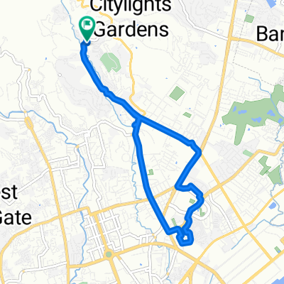
6th Street 69, Mandaue City to 6th, Cebu City
- 16.9 km
- 262 m
- 294 m
- Apas, Central Visayas, Philippines
A cycling route starting in Apas, Central Visayas, Philippines.
Overview
created this 5 years ago
Route quality
Quiet road
10.6 km
(38 %)
Road
4.5 km
(16 %)
Paved
12.3 km
(44 %)
Unpaved
2 km
(7 %)
Asphalt
9.5 km
(34 %)
Paved (undefined)
1.4 km
(5 %)
Route highlights
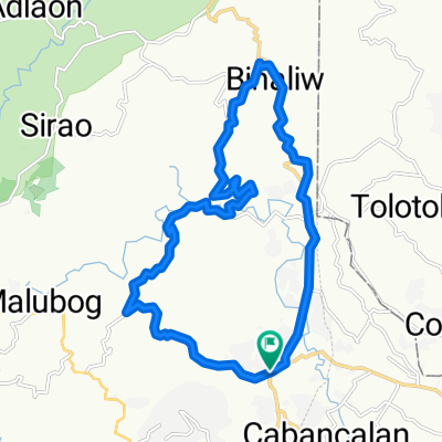
jy mall
Continue with Bikemap
You would like to ride jy-talamban-pulangbato-malubog-jy or customize it for your own trip? Here is what you can do with this Bikemap route:
Free trial for 3 days, or one-time payment. More about Bikemap Premium.
Discover more Premium features.
Get Bikemap PremiumFrom our community
Open it in the app