
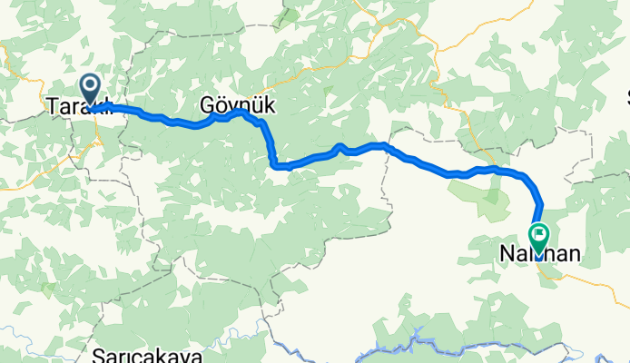
2008-22.7. Tarakli- Nallihan
A cycling route starting in Taraklı, Sakarya Province, Republic of Türkiye.
Overview
About this route
- -:--
- Duration
- 95.9 km
- Distance
- 1,123 m
- Ascent
- 953 m
- Descent
- ---
- Avg. speed
- ---
- Max. altitude
Route quality
Waytypes & surfaces along the route
Waytypes
Quiet road
2.9 km
(3 %)
Track
1.9 km
(2 %)
Surfaces
Paved
31.6 km
(33 %)
Asphalt
31.6 km
(33 %)
Undefined
64.2 km
(67 %)
Route highlights
Points of interest along the route

Photo after 0.3 km
Motel

Photo after 32.7 km
Schießübungen?

Photo after 80.1 km
ab jetzt geht's bergab

Photo after 95.4 km
Hauptstraße Nallihan
Continue with Bikemap
Use, edit, or download this cycling route
You would like to ride 2008-22.7. Tarakli- Nallihan or customize it for your own trip? Here is what you can do with this Bikemap route:
Free features
- Save this route as favorite or in collections
- Copy & plan your own version of this route
- Split it into stages to create a multi-day tour
- Sync your route with Garmin or Wahoo
Premium features
Free trial for 3 days, or one-time payment. More about Bikemap Premium.
- Navigate this route on iOS & Android
- Export a GPX / KML file of this route
- Create your custom printout (try it for free)
- Download this route for offline navigation
Discover more Premium features.
Get Bikemap PremiumFrom our community
Other popular routes starting in Taraklı
 2008-22.7. Tarakli- Nallihan
- Distance
- 95.9 km
- Ascent
- 1,123 m
- Descent
- 953 m
- Location
- Taraklı, Sakarya Province, Republic of Türkiye
 Taraklı - Avdan - Karagöl - Acelle Yaylası
- Distance
- 33.6 km
- Ascent
- 1,146 m
- Descent
- 433 m
- Location
- Taraklı, Sakarya Province, Republic of Türkiye
 Ziua 7
- Distance
- 196.5 km
- Ascent
- 2,654 m
- Descent
- 2,376 m
- Location
- Taraklı, Sakarya Province, Republic of Türkiye
Open it in the app