

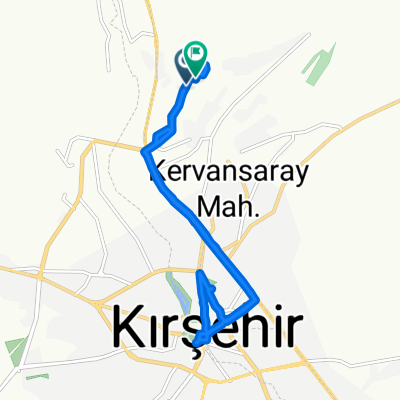
2008-27.7. Kirsehir- Göreme
A cycling route starting in Kırşehir, Kırşehir Province, Republic of Türkiye.
Overview
About this route
- -:--
- Duration
- 111.2 km
- Distance
- 864 m
- Ascent
- 734 m
- Descent
- ---
- Avg. speed
- ---
- Max. altitude
Route highlights
Points of interest along the route

Photo after 20.7 km
Dorf in Anatolien

Photo after 63 km
endlose Landschaft

Photo after 103.1 km
Ziegelproduktion in Avanos

Photo after 107.4 km
Kapatokien

Photo after 111.2 km
meine Wohnhöhle
Continue with Bikemap
Use, edit, or download this cycling route
You would like to ride 2008-27.7. Kirsehir- Göreme or customize it for your own trip? Here is what you can do with this Bikemap route:
Free features
- Save this route as favorite or in collections
- Copy & plan your own version of this route
- Split it into stages to create a multi-day tour
- Sync your route with Garmin or Wahoo
Premium features
Free trial for 3 days, or one-time payment. More about Bikemap Premium.
- Navigate this route on iOS & Android
- Export a GPX / KML file of this route
- Create your custom printout (try it for free)
- Download this route for offline navigation
Discover more Premium features.
Get Bikemap PremiumFrom our community
Other popular routes starting in Kırşehir
 Kırşehir - Mucur
- Distance
- 26.4 km
- Ascent
- 232 m
- Descent
- 141 m
- Location
- Kırşehir, Kırşehir Province, Republic of Türkiye
 Kırşehir - Seyfe Lake
- Distance
- 35.4 km
- Ascent
- 519 m
- Descent
- 381 m
- Location
- Kırşehir, Kırşehir Province, Republic of Türkiye
 Kırşehir - Kaman - Hirfanlı Dam
- Distance
- 86.9 km
- Ascent
- 1,116 m
- Descent
- 1,247 m
- Location
- Kırşehir, Kırşehir Province, Republic of Türkiye
 Şehit Muammer Yavuz Caddesi to Şehit Muammer Yavuz Caddesi
- Distance
- 14.4 km
- Ascent
- 322 m
- Descent
- 316 m
- Location
- Kırşehir, Kırşehir Province, Republic of Türkiye
 1471. Sokak 12 to Güldiken Caddesi 14
- Distance
- 3.9 km
- Ascent
- 14 m
- Descent
- 10 m
- Location
- Kırşehir, Kırşehir Province, Republic of Türkiye
 Kırşehir - Özbağ - Dulkadirli Underground City
- Distance
- 45.3 km
- Ascent
- 363 m
- Descent
- 261 m
- Location
- Kırşehir, Kırşehir Province, Republic of Türkiye
 bağbaşı
- Distance
- 2.4 km
- Ascent
- 45 m
- Descent
- 4 m
- Location
- Kırşehir, Kırşehir Province, Republic of Türkiye
 Kırşehir - Kesikköprü - Cacabey Caravanserai - Yunus Emre Tomb
- Distance
- 44.6 km
- Ascent
- 643 m
- Descent
- 375 m
- Location
- Kırşehir, Kırşehir Province, Republic of Türkiye
Open it in the app