
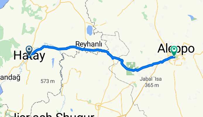
2008-5.8. Antakya- Aleppo
A cycling route starting in Antakya, Hatay Province, Republic of Türkiye.
Overview
About this route
- -:--
- Duration
- 103.7 km
- Distance
- 597 m
- Ascent
- 311 m
- Descent
- ---
- Avg. speed
- ---
- Max. altitude
Route highlights
Points of interest along the route

Photo after 10.6 km
auf zur letzten Etappe

Photo after 48.4 km
in der Nähe der Grenze

Photo after 79.8 km
schaut schon anders aus

Photo after 100.9 km
am Ziel

Photo after 103.7 km
schönes Hotel zum Schluß
Continue with Bikemap
Use, edit, or download this cycling route
You would like to ride 2008-5.8. Antakya- Aleppo or customize it for your own trip? Here is what you can do with this Bikemap route:
Free features
- Save this route as favorite or in collections
- Copy & plan your own version of this route
- Split it into stages to create a multi-day tour
- Sync your route with Garmin or Wahoo
Premium features
Free trial for 3 days, or one-time payment. More about Bikemap Premium.
- Navigate this route on iOS & Android
- Export a GPX / KML file of this route
- Create your custom printout (try it for free)
- Download this route for offline navigation
Discover more Premium features.
Get Bikemap PremiumFrom our community
Other popular routes starting in Antakya
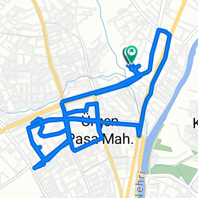
 göçmen kuş cenneti
- Distance
- 35.1 km
- Ascent
- 502 m
- Descent
- 590 m
- Location
- Antakya, Hatay Province, Republic of Türkiye
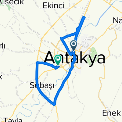
 Iskenderun -Antakya parkuru
- Distance
- 116.5 km
- Ascent
- 509 m
- Descent
- 586 m
- Location
- Antakya, Hatay Province, Republic of Türkiye
 Morgul Sk. 36, Hatay Merkez to Morgul Sk. 36, Hatay Merkez
- Distance
- 15.2 km
- Ascent
- 50 m
- Descent
- 51 m
- Location
- Antakya, Hatay Province, Republic of Türkiye
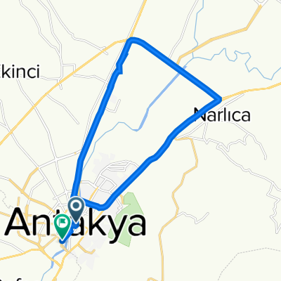
 Ziua 12
- Distance
- 196.6 km
- Ascent
- 1,291 m
- Descent
- 1,362 m
- Location
- Antakya, Hatay Province, Republic of Türkiye
 Ataturk Blv. 58B, Hatay Merkez to 105. Sk. 16, Defne
- Distance
- 22 km
- Ascent
- 200 m
- Descent
- 185 m
- Location
- Antakya, Hatay Province, Republic of Türkiye
 3041. Sk. 16, Hatay Merkez to Tahtaköprü Mh., Hatay Merkez
- Distance
- 20.3 km
- Ascent
- 186 m
- Descent
- 113 m
- Location
- Antakya, Hatay Province, Republic of Türkiye
 Ataturk Blv. 2C, Hatay Merkez to Ataturk Parki Ici Yolu, Hatay Merkez
- Distance
- 18.8 km
- Ascent
- 78 m
- Descent
- 79 m
- Location
- Antakya, Hatay Province, Republic of Türkiye
 89. Sk., Defne to 105. Sk. 16, Defne
- Distance
- 24.4 km
- Ascent
- 709 m
- Descent
- 711 m
- Location
- Antakya, Hatay Province, Republic of Türkiye
Open it in the app