

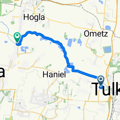
bat hefer to beit yanai
A cycling route starting in Tulkarm, West Bank, Palestine.
Overview
About this route
- 1 h 25 min
- Duration
- 19.7 km
- Distance
- 151 m
- Ascent
- 189 m
- Descent
- 13.8 km/h
- Avg. speed
- ---
- Max. altitude

Route quality
Waytypes & surfaces along the route
Waytypes
Track
9.2 km
(47 %)
Quiet road
4.3 km
(22 %)
Surfaces
Paved
2.2 km
(11 %)
Unpaved
0.2 km
(1 %)
Asphalt
1.8 km
(9 %)
Paved (undefined)
0.4 km
(2 %)
Continue with Bikemap
Use, edit, or download this cycling route
You would like to ride bat hefer to beit yanai or customize it for your own trip? Here is what you can do with this Bikemap route:
Free features
- Save this route as favorite or in collections
- Copy & plan your own version of this route
- Sync your route with Garmin or Wahoo
Premium features
Free trial for 3 days, or one-time payment. More about Bikemap Premium.
- Navigate this route on iOS & Android
- Export a GPX / KML file of this route
- Create your custom printout (try it for free)
- Download this route for offline navigation
Discover more Premium features.
Get Bikemap PremiumFrom our community
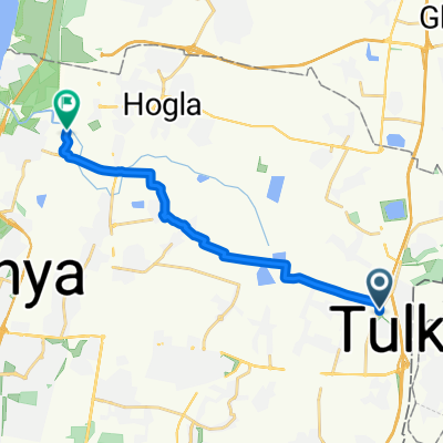
Other popular routes starting in Tulkarm
 bat hefer to beit yanai
- Distance
- 19.7 km
- Ascent
- 151 m
- Descent
- 189 m
- Location
- Tulkarm, West Bank, Palestine
 מבת חפר לגשר הצבים נחל אלכסנדר
- Distance
- 16.6 km
- Ascent
- 108 m
- Descent
- 160 m
- Location
- Tulkarm, West Bank, Palestine
 Relaxed route in
- Distance
- 15 km
- Ascent
- 3 m
- Descent
- 50 m
- Location
- Tulkarm, West Bank, Palestine
 Steady ride in Netanya
- Distance
- 21 km
- Ascent
- 98 m
- Descent
- 131 m
- Location
- Tulkarm, West Bank, Palestine
 Work
Work- Distance
- 19.1 km
- Ascent
- 88 m
- Descent
- 120 m
- Location
- Tulkarm, West Bank, Palestine
 5714 to Turtles Park
- Distance
- 14.7 km
- Ascent
- 87 m
- Descent
- 127 m
- Location
- Tulkarm, West Bank, Palestine
 Slow ride in Netanyaggf.
- Distance
- 18.3 km
- Ascent
- 68 m
- Descent
- 100 m
- Location
- Tulkarm, West Bank, Palestine
 גמלא 40, בת חפר to מורד התאנה 18, ינוב
- Distance
- 25.6 km
- Ascent
- 176 m
- Descent
- 184 m
- Location
- Tulkarm, West Bank, Palestine
Open it in the app