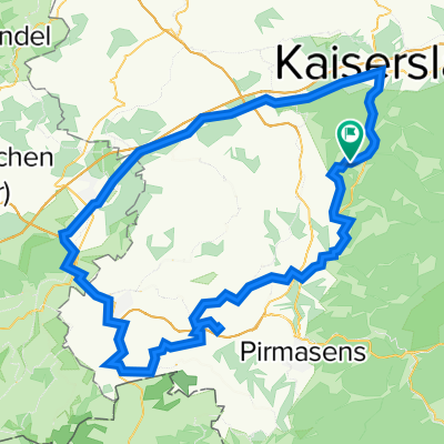
Krickenbach - Kaiserslautern City - Hochspeyer - Enkenbach - Spirkelbach - Donnersberg - Rockenhausen - Höringer Tal - Otterbach - Otterberg - Erfenbach - KL We
A cycling route starting in Krickenbach, Rhineland-Palatinate, Germany.
Overview
About this route
Krickenbach nach "Downtown" KL über Hochspeyer zum Donnersberg Massiv. Rockenhausener Landstrasse bis zum Otterbacher Spitz. Relaitv verkehrsarm aber durch Kaiserslautern durch und einige Bundesstrassen. Teilweise Anspruchsvoll mit guten Rollerpassagen.
- -:--
- Duration
- 107.3 km
- Distance
- 679 m
- Ascent
- 662 m
- Descent
- ---
- Avg. speed
- ---
- Max. altitude
Route quality
Waytypes & surfaces along the route
Waytypes
Busy road
61.5 km
(57 %)
Quiet road
12.3 km
(11 %)
Surfaces
Paved
87.5 km
(82 %)
Unpaved
2.8 km
(3 %)
Asphalt
83.3 km
(78 %)
Paved (undefined)
2.2 km
(2 %)
Continue with Bikemap
Use, edit, or download this cycling route
You would like to ride Krickenbach - Kaiserslautern City - Hochspeyer - Enkenbach - Spirkelbach - Donnersberg - Rockenhausen - Höringer Tal - Otterbach - Otterberg - Erfenbach - KL We or customize it for your own trip? Here is what you can do with this Bikemap route:
Free features
- Save this route as favorite or in collections
- Copy & plan your own version of this route
- Split it into stages to create a multi-day tour
- Sync your route with Garmin or Wahoo
Premium features
Free trial for 3 days, or one-time payment. More about Bikemap Premium.
- Navigate this route on iOS & Android
- Export a GPX / KML file of this route
- Create your custom printout (try it for free)
- Download this route for offline navigation
Discover more Premium features.
Get Bikemap PremiumFrom our community
Other popular routes starting in Krickenbach
- RTF "Durch den Pfälzer Wald und .." des RV 1921 Schopp e.V. (149km)
- Distance
- 145.7 km
- Ascent
- 2,118 m
- Descent
- 2,059 m
- Location
- Krickenbach, Rhineland-Palatinate, Germany
- Krickenbach-Petersberg-Rolbing-Walschbronn-Philipsbourg-Niederbronn-Jaegerthal-Schönau-Bundenthal-Sarnstall-Johanneskreuz-Karlstal-Krickenbach
- Distance
- 184.2 km
- Ascent
- 900 m
- Descent
- 892 m
- Location
- Krickenbach, Rhineland-Palatinate, Germany
- Krickenbach - Petersberg - Waldbronn - Niederbronn de Bains - Jaegerthal - Lembach -Schönau - Fischbach - Salzwoog - Hinterweidenthal - Merzalbern - W.fischbach
- Distance
- 170.2 km
- Ascent
- 900 m
- Descent
- 900 m
- Location
- Krickenbach, Rhineland-Palatinate, Germany
- Krickenbach - Waldziegelhütte - Ramstein - Krickenbach
- Distance
- 98.8 km
- Ascent
- 737 m
- Descent
- 737 m
- Location
- Krickenbach, Rhineland-Palatinate, Germany
- Krickenbach - Zweibrücken - Homburg - Landstuhl - Krickenbach
- Distance
- 98.1 km
- Ascent
- 390 m
- Descent
- 404 m
- Location
- Krickenbach, Rhineland-Palatinate, Germany
- Krickenbach - Welsbach - Rolbing - Klein Frankreich - Waldbronn - Kröppen - Eppenbrun - Hinterweidenthal - Münchweiler - Rodalben - W.fischbach - Krickenbach
- Distance
- 114 km
- Ascent
- 644 m
- Descent
- 644 m
- Location
- Krickenbach, Rhineland-Palatinate, Germany
- Krickenbach - Johanniskreuz - Wellbachtal - Vorderweidenthal - Bundenthal - Dahn - Hinterweidenthal - Münchweiler a. d . Rd. - Waldfischbach - Krickenbach
- Distance
- 104 km
- Ascent
- 674 m
- Descent
- 652 m
- Location
- Krickenbach, Rhineland-Palatinate, Germany
- Krickenbach - KL - Enkenbach - Ramsen - Grünstad - Deutsche Weinstrasse - Bad Dürkheim - Neustadt - Frankenstein - Hochspeyer - KL City - Hohenecken - Krickenba
- Distance
- 130.4 km
- Ascent
- 560 m
- Descent
- 507 m
- Location
- Krickenbach, Rhineland-Palatinate, Germany
Open it in the app