
Avio - Riva del Garda
A cycling route starting in Avio, Trentino-Alto Adige, Italy.
Overview
About this route
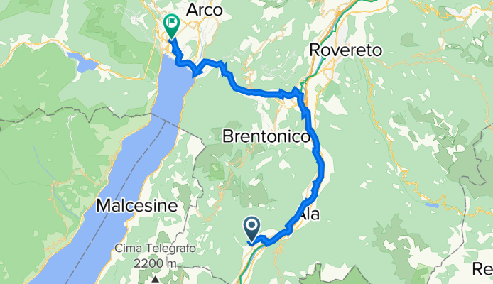
Avio - Santa Margherita - Torbole Riva.\n\nReturn
- -:--
- Duration
- 36.3 km
- Distance
- 234 m
- Ascent
- 294 m
- Descent
- ---
- Avg. speed
- ---
- Max. altitude

Route quality
Waytypes & surfaces along the route
Waytypes
Cycleway
22.5 km
(62 %)
Quiet road
10.9 km
(30 %)
Surfaces
Paved
29.8 km
(82 %)
Asphalt
29.8 km
(82 %)
Undefined
6.5 km
(18 %)
Continue with Bikemap
Use, edit, or download this cycling route
You would like to ride Avio - Riva del Garda or customize it for your own trip? Here is what you can do with this Bikemap route:
Free features
- Save this route as favorite or in collections
- Copy & plan your own version of this route
- Sync your route with Garmin or Wahoo
Premium features
Free trial for 3 days, or one-time payment. More about Bikemap Premium.
- Navigate this route on iOS & Android
- Export a GPX / KML file of this route
- Create your custom printout (try it for free)
- Download this route for offline navigation
Discover more Premium features.
Get Bikemap PremiumFrom our community
Other popular routes starting in Avio
 Avio zum Monte Baldo
- Distance
- 19.9 km
- Ascent
- 1,601 m
- Descent
- 21 m
- Location
- Avio, Trentino-Alto Adige, Italy
 Chizzola Brentonico San Valentino Graziani Prà Alpesina Avio
- Distance
- 57.9 km
- Ascent
- 1,530 m
- Descent
- 1,530 m
- Location
- Avio, Trentino-Alto Adige, Italy
 Recording from 24 Dicembre, 10:46
- Distance
- 2.9 km
- Ascent
- 56 m
- Descent
- 73 m
- Location
- Avio, Trentino-Alto Adige, Italy
 Etsch Brentino-Belluno - Bardolino
- Distance
- 32.8 km
- Ascent
- 304 m
- Descent
- 337 m
- Location
- Avio, Trentino-Alto Adige, Italy
 3°tappa: Avio-Verona
- Distance
- 51.1 km
- Ascent
- 140 m
- Descent
- 222 m
- Location
- Avio, Trentino-Alto Adige, Italy
 Ciclovia del Sole 2 variante Verona 2 Ciclabile Terra dei Forti
- Distance
- 38.6 km
- Ascent
- 416 m
- Descent
- 450 m
- Location
- Avio, Trentino-Alto Adige, Italy
 Garda - Sabbionara
- Distance
- 44.7 km
- Ascent
- 1,502 m
- Descent
- 1,502 m
- Location
- Avio, Trentino-Alto Adige, Italy
 Borghetto - Santuario - Vò
- Distance
- 70.3 km
- Ascent
- 1,927 m
- Descent
- 1,916 m
- Location
- Avio, Trentino-Alto Adige, Italy
Open it in the app