

UP and DOWN en Chevreuse
A cycling route starting in Orsay, Île-de-France Region, France.
Overview
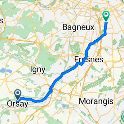
About this route
Partons de Orsay ville en direction de la forêt de Rambouillet par des routes tranquilles. / Un stop aux étangs de Hollande pour la pause photo et on repart vers la vallée en passant par les Vaux de Cernay. / Très chouette parcours vallonné.
- 4 h 43 min
- Duration
- 75 km
- Distance
- 564 m
- Ascent
- 562 m
- Descent
- 15.9 km/h
- Avg. speed
- ---
- Max. altitude

Route quality
Waytypes & surfaces along the route
Waytypes
Road
27.8 km
(37 %)
Quiet road
18 km
(24 %)
Surfaces
Paved
35.3 km
(47 %)
Asphalt
35.3 km
(47 %)
Undefined
39.8 km
(53 %)
Continue with Bikemap
Use, edit, or download this cycling route
You would like to ride UP and DOWN en Chevreuse or customize it for your own trip? Here is what you can do with this Bikemap route:
Free features
- Save this route as favorite or in collections
- Copy & plan your own version of this route
- Sync your route with Garmin or Wahoo
Premium features
Free trial for 3 days, or one-time payment. More about Bikemap Premium.
- Navigate this route on iOS & Android
- Export a GPX / KML file of this route
- Create your custom printout (try it for free)
- Download this route for offline navigation
Discover more Premium features.
Get Bikemap PremiumFrom our community
Other popular routes starting in Orsay
 Nord 1 S1
- Distance
- 33.7 km
- Ascent
- 206 m
- Descent
- 203 m
- Location
- Orsay, Île-de-France Region, France
 Orsay VJ straight
- Distance
- 19.9 km
- Ascent
- 132 m
- Descent
- 117 m
- Location
- Orsay, Île-de-France Region, France
 Rue Louis Scocard, Orsay à Le Clos des Cèdres, Orsay
- Distance
- 1 km
- Ascent
- 58 m
- Descent
- 4 m
- Location
- Orsay, Île-de-France Region, France
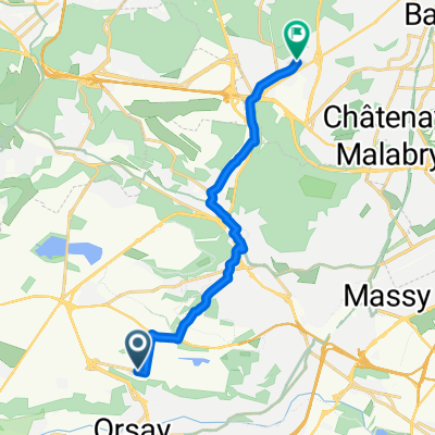
 Orsay - Rambouillet (Les étangs d'Hollande) Aller
- Distance
- 37.5 km
- Ascent
- 365 m
- Descent
- 247 m
- Location
- Orsay, Île-de-France Region, France
 Orsay Paris
- Distance
- 30.1 km
- Ascent
- 156 m
- Descent
- 181 m
- Location
- Orsay, Île-de-France Region, France
 Orsay-Orsay
- Distance
- 11 km
- Ascent
- 149 m
- Descent
- 157 m
- Location
- Orsay, Île-de-France Region, France
 De Corbeville, Orsay à Rue de Normandie 1, Clamart
- Distance
- 11.6 km
- Ascent
- 164 m
- Descent
- 152 m
- Location
- Orsay, Île-de-France Region, France
 Bures-sur-Yvette - Montmartre
- Distance
- 49.5 km
- Ascent
- 149 m
- Descent
- 163 m
- Location
- Orsay, Île-de-France Region, France
Open it in the app