Krickenbach - Welsbach - Rolbing - Klein Frankreich - Waldbronn - Kröppen - Eppenbrun - Hinterweidenthal - Münchweiler - Rodalben - W.fischbach - Krickenbach
A cycling route starting in Krickenbach, Rhineland-Palatinate, Germany.
Overview
About this route
Kleine Frankreich Runde - relativ verkehrsarm. Schöne Runde teilweise durch Frankreich zum Wasgau.
- -:--
- Duration
- 114 km
- Distance
- 644 m
- Ascent
- 644 m
- Descent
- ---
- Avg. speed
- ---
- Avg. speed
Route quality
Waytypes & surfaces along the route
Waytypes
Busy road
52.7 km
(46 %)
Road
30.4 km
(27 %)
Surfaces
Paved
72.1 km
(63 %)
Unpaved
8.1 km
(7 %)
Asphalt
69.1 km
(61 %)
Unpaved (undefined)
3.6 km
(3 %)
Continue with Bikemap
Use, edit, or download this cycling route
You would like to ride Krickenbach - Welsbach - Rolbing - Klein Frankreich - Waldbronn - Kröppen - Eppenbrun - Hinterweidenthal - Münchweiler - Rodalben - W.fischbach - Krickenbach or customize it for your own trip? Here is what you can do with this Bikemap route:
Free features
- Save this route as favorite or in collections
- Copy & plan your own version of this route
- Sync your route with Garmin or Wahoo
Premium features
Free trial for 3 days, or one-time payment. More about Bikemap Premium.
- Navigate this route on iOS & Android
- Export a GPX / KML file of this route
- Create your custom printout (try it for free)
- Download this route for offline navigation
Discover more Premium features.
Get Bikemap PremiumFrom our community
Other popular routes starting in Krickenbach
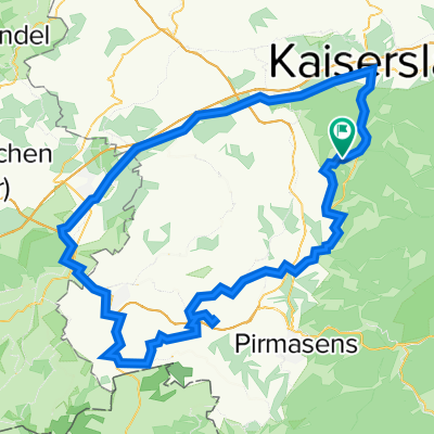
- Krickenbach - Waldziegelhütte - Ramstein - Krickenbach
- Distance
- 98.8 km
- Ascent
- 737 m
- Descent
- 737 m
- Location
- Krickenbach, Rhineland-Palatinate, Germany
- Krickenbach - Johanniskreuz - Wellbachtal - Vorderweidenthal - Bundenthal - Dahn - Hinterweidenthal - Münchweiler a. d . Rd. - Waldfischbach - Krickenbach
- Distance
- 104 km
- Ascent
- 674 m
- Descent
- 652 m
- Location
- Krickenbach, Rhineland-Palatinate, Germany
- Pulvermühle und Pulverweiher
- Distance
- 15.4 km
- Ascent
- 312 m
- Descent
- 311 m
- Location
- Krickenbach, Rhineland-Palatinate, Germany
- RTF "Durch den Pfälzer Wald und .." des RV 1921 Schopp e.V. (149km)
- Distance
- 145.7 km
- Ascent
- 2,118 m
- Descent
- 2,059 m
- Location
- Krickenbach, Rhineland-Palatinate, Germany
- Krickenbach - Welsbach - Rolbing - Klein Frankreich - Waldbronn - Kröppen - Eppenbrun - Hinterweidenthal - Münchweiler - Rodalben - W.fischbach - Krickenbach
- Distance
- 114 km
- Ascent
- 644 m
- Descent
- 644 m
- Location
- Krickenbach, Rhineland-Palatinate, Germany
- Krickenbach-Petersberg-Rolbing-Walschbronn-Philipsbourg-Niederbronn-Jaegerthal-Schönau-Bundenthal-Sarnstall-Johanneskreuz-Karlstal-Krickenbach
- Distance
- 184.2 km
- Ascent
- 900 m
- Descent
- 892 m
- Location
- Krickenbach, Rhineland-Palatinate, Germany
- Krickenbach - Kaiserslautern City - Hochspeyer - Enkenbach - Spirkelbach - Donnersberg - Rockenhausen - Höringer Tal - Otterbach - Otterberg - Erfenbach - KL We
- Distance
- 107.3 km
- Ascent
- 679 m
- Descent
- 662 m
- Location
- Krickenbach, Rhineland-Palatinate, Germany
- Krickenbach - Johanniskreuz - Leimen - Clausen - Rodalben - Waldfischbach - Horbach - Krickenbach
- Distance
- 66.7 km
- Ascent
- 556 m
- Descent
- 556 m
- Location
- Krickenbach, Rhineland-Palatinate, Germany
Open it in the app