

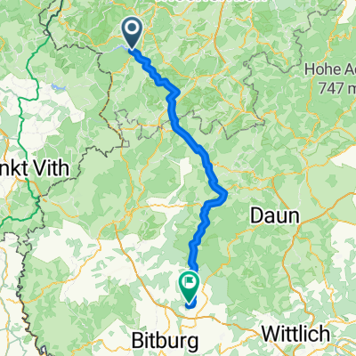
EifelSpur Westwall (Gemeinde Hellenthal)
A cycling route starting in Hellenthal, North Rhine-Westphalia, Germany.
Overview
About this route
Hiking along the West Wall - a military defense system along the western border of the former 'German Reich', measuring 630 kilometers at the time.
- 1 h 15 min
- Duration
- 13.1 km
- Distance
- 244 m
- Ascent
- 241 m
- Descent
- 10.4 km/h
- Avg. speed
- ---
- Max. altitude

Route quality
Waytypes & surfaces along the route
Waytypes
Track
10.6 km
(81 %)
Quiet road
1.7 km
(13 %)
Access road
0.8 km
(6 %)
Surfaces
Paved
0.7 km
(5 %)
Unpaved
8.9 km
(68 %)
Gravel
7.7 km
(59 %)
Unpaved (undefined)
1.2 km
(9 %)
Continue with Bikemap
Use, edit, or download this cycling route
You would like to ride EifelSpur Westwall (Gemeinde Hellenthal) or customize it for your own trip? Here is what you can do with this Bikemap route:
Free features
- Save this route as favorite or in collections
- Copy & plan your own version of this route
- Sync your route with Garmin or Wahoo
Premium features
Free trial for 3 days, or one-time payment. More about Bikemap Premium.
- Navigate this route on iOS & Android
- Export a GPX / KML file of this route
- Create your custom printout (try it for free)
- Download this route for offline navigation
Discover more Premium features.
Get Bikemap PremiumFrom our community
Other popular routes starting in Hellenthal
 Hellenthal Ländchen Kall
- Distance
- 37 km
- Ascent
- 555 m
- Descent
- 555 m
- Location
- Hellenthal, North Rhine-Westphalia, Germany
 Jan De Laet Fietsweekend Kris 201906 Maandag
- Distance
- 57 km
- Ascent
- 530 m
- Descent
- 861 m
- Location
- Hellenthal, North Rhine-Westphalia, Germany
 2020 Runde um Olefstausee
- Distance
- 19.4 km
- Ascent
- 308 m
- Descent
- 281 m
- Location
- Hellenthal, North Rhine-Westphalia, Germany
 Bauesfeld, Hellenthal naar Hochstraße, Kyllburg
- Distance
- 74.1 km
- Ascent
- 893 m
- Descent
- 1,025 m
- Location
- Hellenthal, North Rhine-Westphalia, Germany
 Platißbach
- Distance
- 20.3 km
- Ascent
- 377 m
- Descent
- 376 m
- Location
- Hellenthal, North Rhine-Westphalia, Germany
 EifelSpur Westwall (Gemeinde Hellenthal)
- Distance
- 13.1 km
- Ascent
- 244 m
- Descent
- 241 m
- Location
- Hellenthal, North Rhine-Westphalia, Germany
 Hellenthal
- Distance
- 75.2 km
- Ascent
- 1,419 m
- Descent
- 1,416 m
- Location
- Hellenthal, North Rhine-Westphalia, Germany
 Prethtal - Narzissenwiesen - Oleftalsperre
- Distance
- 31.9 km
- Ascent
- 376 m
- Descent
- 376 m
- Location
- Hellenthal, North Rhine-Westphalia, Germany
Open it in the app