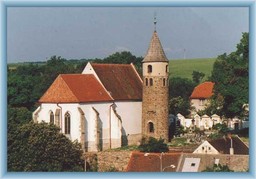
vranovská přehrada
A cycling route starting in Jemnice, Kraj Vysočina, Czechia.
Overview
About this route
- -:--
- Duration
- 84 km
- Distance
- 1,148 m
- Ascent
- 1,186 m
- Descent
- ---
- Avg. speed
- 492 m
- Max. altitude
Route quality
Waytypes & surfaces along the route
Waytypes
Road
56.3 km
(67 %)
Quiet road
4.2 km
(5 %)
Surfaces
Paved
2.5 km
(3 %)
Unpaved
0.8 km
(1 %)
Asphalt
2.5 km
(3 %)
Unpaved (undefined)
0.8 km
(1 %)
Undefined
80.6 km
(96 %)
Route highlights
Points of interest along the route

Point of interest after 1.8 km
kostel sv. Jakuba v Jemnici

Photo after 19.9 km
Uherčice zámek

Photo after 26.7 km
Podhradí nad dyjí zřícenina Frejštejn

Photo after 38.6 km
zámek Vranov nad Dyjí

Photo after 41 km
Clarryho kříž

Point of interest after 41 km
Vranovská pláž

Point of interest after 41.2 km
přehrada

Photo after 51.4 km
zřícenina Cornštejn

Point of interest after 52.7 km
vysočanský most

Photo after 52.7 km
hrad Bítov

Accommodation after 56 km
obec Bítov
Continue with Bikemap
Use, edit, or download this cycling route
You would like to ride vranovská přehrada or customize it for your own trip? Here is what you can do with this Bikemap route:
Free features
- Save this route as favorite or in collections
- Copy & plan your own version of this route
- Split it into stages to create a multi-day tour
- Sync your route with Garmin or Wahoo
Premium features
Free trial for 3 days, or one-time payment. More about Bikemap Premium.
- Navigate this route on iOS & Android
- Export a GPX / KML file of this route
- Create your custom printout (try it for free)
- Download this route for offline navigation
Discover more Premium features.
Get Bikemap PremiumFrom our community
Other popular routes starting in Jemnice
 dačice, český rudolec, česká kanada, zvůle, telč
- Distance
- 90.7 km
- Ascent
- 1,092 m
- Descent
- 1,096 m
- Location
- Jemnice, Kraj Vysočina, Czechia
 slavonice, landštejn, kaproun, úzkokolejka, maříž
- Distance
- 95.1 km
- Ascent
- 863 m
- Descent
- 863 m
- Location
- Jemnice, Kraj Vysočina, Czechia
 Jemnice-St.Hobzí-Písečné-Rančířov-Dešná-Jemnice
- Distance
- 38.4 km
- Ascent
- 349 m
- Descent
- 346 m
- Location
- Jemnice, Kraj Vysočina, Czechia
 Jemnický okruh CLONED FROM ROUTE 224191
- Distance
- 34.6 km
- Ascent
- 296 m
- Descent
- 296 m
- Location
- Jemnice, Kraj Vysočina, Czechia
 z Jemnice na Javořici a zpět
- Distance
- 92 km
- Ascent
- 1,098 m
- Descent
- 1,079 m
- Location
- Jemnice, Kraj Vysočina, Czechia
 Jemnicko
- Distance
- 46.7 km
- Ascent
- 375 m
- Descent
- 376 m
- Location
- Jemnice, Kraj Vysočina, Czechia
 podyjí a znojmo
- Distance
- 71.2 km
- Ascent
- 997 m
- Descent
- 1,168 m
- Location
- Jemnice, Kraj Vysočina, Czechia
 Jemnice - Vydří
- Distance
- 17.2 km
- Ascent
- 175 m
- Descent
- 158 m
- Location
- Jemnice, Kraj Vysočina, Czechia
Open it in the app


