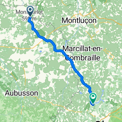
Châteaumeillant - Sancoins
- 72.5 km
- 911 m
- 1,165 m
- Gouzon, Nouvelle-Aquitaine, France
A cycling route starting in Gouzon, Nouvelle-Aquitaine, France.
Overview
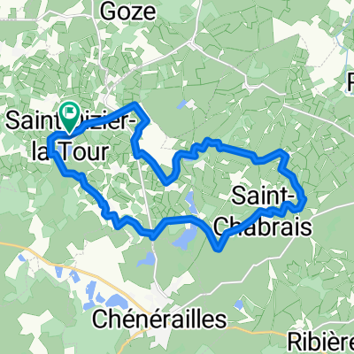
Hilly circuit starting from Chénérailles in Creuse.
Departure from Chénérailles towards Saint-Loup passing by the étang de Pinaud to join the D993 which is lightly trafficked<br />
Leave the D993 at La-Croix-de-la-Fortune to reach Néoux passing through Saint-Alpinien<br />
Beautiful descent towards Aubusson via the Gorges de la Rozeille (classified site) <br />
Follow the left bank of the Creuse and then reach Ahun<br />
Descent into Moutier-d'Ahun where there is a beautiful Abbey and a Romanesque bridge<br />
Return to Chénérailles via Mornat, then the lightly trafficked D55
created this 15 years ago
Route quality
Road
51.4 km
59 %
Quiet road
8.7 km
10 %
Paved
27 km
(31 %)
Asphalt
27 km
31 %
Undefined
60.2 km
69 %
Route highlights
Après une bon raidillon, belle vue depuis les ruines du château.
Le Pont de la Terrade sur la Creuse
Petite église du 12ème siècle dans un endroit paisible où l'on peu pique-niquer.
Le château de Villemonteix vaut le coup d'œil.
Continue with Bikemap
You would like to ride Circuit en Creuse (Chénérailles / Aubusson / Ahun) or customize it for your own trip? Here is what you can do with this Bikemap route:
Free trial for 3 days, or one-time payment. More about Bikemap Premium.
Discover more Premium features.
Get Bikemap PremiumFrom our community
Open it in the app