

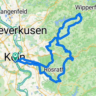
Köln-Gö
A cycling route starting in Altstadt Sud, North Rhine-Westphalia, Germany.
Overview
About this route
- -:--
- Duration
- 278.2 km
- Distance
- 1,738 m
- Ascent
- 1,642 m
- Descent
- ---
- Avg. speed
- ---
- Max. altitude
Route quality
Waytypes & surfaces along the route
Waytypes
Path
64 km
(23 %)
Road
41.7 km
(15 %)
Surfaces
Paved
225.4 km
(81 %)
Unpaved
13.9 km
(5 %)
Asphalt
217 km
(78 %)
Gravel
11.1 km
(4 %)
Continue with Bikemap
Use, edit, or download this cycling route
You would like to ride Köln-Gö or customize it for your own trip? Here is what you can do with this Bikemap route:
Free features
- Save this route as favorite or in collections
- Copy & plan your own version of this route
- Split it into stages to create a multi-day tour
- Sync your route with Garmin or Wahoo
Premium features
Free trial for 3 days, or one-time payment. More about Bikemap Premium.
- Navigate this route on iOS & Android
- Export a GPX / KML file of this route
- Create your custom printout (try it for free)
- Download this route for offline navigation
Discover more Premium features.
Get Bikemap PremiumFrom our community
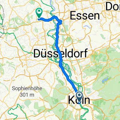
Other popular routes starting in Altstadt Sud
 Rund um Köln 2010
- Distance
- 67.2 km
- Ascent
- 488 m
- Descent
- 482 m
- Location
- Altstadt Sud, North Rhine-Westphalia, Germany
 Bornheimer-Bach Radtour
- Distance
- 57.6 km
- Ascent
- 87 m
- Descent
- 83 m
- Location
- Altstadt Sud, North Rhine-Westphalia, Germany
 Altstadt Sud - Weißenthurm
- Distance
- 80.5 km
- Ascent
- 497 m
- Descent
- 477 m
- Location
- Altstadt Sud, North Rhine-Westphalia, Germany
 Einmal ummen Airport
- Distance
- 50.4 km
- Ascent
- 130 m
- Descent
- 131 m
- Location
- Altstadt Sud, North Rhine-Westphalia, Germany
 Rund um Köln 2025 - Velodom 120 (120,8km)
- Distance
- 120.6 km
- Ascent
- 1,481 m
- Descent
- 1,477 m
- Location
- Altstadt Sud, North Rhine-Westphalia, Germany
 Altstadt Sud - Moers
- Distance
- 86.9 km
- Ascent
- 189 m
- Descent
- 204 m
- Location
- Altstadt Sud, North Rhine-Westphalia, Germany
 Kölner_Südwestlicher Regionen
- Distance
- 34 km
- Ascent
- 89 m
- Descent
- 91 m
- Location
- Altstadt Sud, North Rhine-Westphalia, Germany
 RuK 2010
- Distance
- 69.1 km
- Ascent
- 366 m
- Descent
- 366 m
- Location
- Altstadt Sud, North Rhine-Westphalia, Germany
Open it in the app