

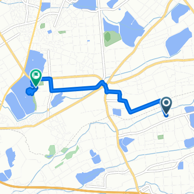
Oka, Inami-Cho, Kako-Gun to Kitayama, Inami-Cho, Kako-Gun
A cycling route starting in Miki, Hyōgo, Japan.
Overview
About this route
- 47 min
- Duration
- 15.7 km
- Distance
- 84 m
- Ascent
- 99 m
- Descent
- 20 km/h
- Avg. speed
- ---
- Max. altitude
Route quality
Waytypes & surfaces along the route
Waytypes
Quiet road
6.8 km
(43 %)
Road
4.1 km
(26 %)
Continue with Bikemap
Use, edit, or download this cycling route
You would like to ride Oka, Inami-Cho, Kako-Gun to Kitayama, Inami-Cho, Kako-Gun or customize it for your own trip? Here is what you can do with this Bikemap route:
Free features
- Save this route as favorite or in collections
- Copy & plan your own version of this route
- Sync your route with Garmin or Wahoo
Premium features
Free trial for 3 days, or one-time payment. More about Bikemap Premium.
- Navigate this route on iOS & Android
- Export a GPX / KML file of this route
- Create your custom printout (try it for free)
- Download this route for offline navigation
Discover more Premium features.
Get Bikemap PremiumFrom our community
Other popular routes starting in Miki
 1丁目, 神戸市 to 高和, 神戸市
- Distance
- 28.9 km
- Ascent
- 303 m
- Descent
- 259 m
- Location
- Miki, Hyōgo, Japan
 がやいん 帰り
- Distance
- 24.9 km
- Ascent
- 401 m
- Descent
- 433 m
- Location
- Miki, Hyōgo, Japan
 淡河ー丹波篠山
- Distance
- 137.8 km
- Ascent
- 2,900 m
- Descent
- 2,900 m
- Location
- Miki, Hyōgo, Japan
 稲美町 to 東所5, 神戸市
- Distance
- 23.9 km
- Ascent
- 407 m
- Descent
- 319 m
- Location
- Miki, Hyōgo, Japan
 国道175号, Nishi-Ku, Kobe-Shi to Kandecho Higashi, Nishi-Ku, Kobe-Shi
- Distance
- 0.4 km
- Ascent
- 0 m
- Descent
- 0 m
- Location
- Miki, Hyōgo, Japan
 Oka, Inami-Cho, Kako-Gun to Kitayama, Inami-Cho, Kako-Gun
- Distance
- 15.7 km
- Ascent
- 84 m
- Descent
- 99 m
- Location
- Miki, Hyōgo, Japan
 1673, Kandecho Hosei, Nishi-Ku, Kobe-Shi to 国道175号, Nishi-Ku, Kobe-Shi
- Distance
- 3.1 km
- Ascent
- 23 m
- Descent
- 0 m
- Location
- Miki, Hyōgo, Japan
 岩岡町野中, 神戸市へ六分一, 稲美町
- Distance
- 4.7 km
- Ascent
- 17 m
- Descent
- 32 m
- Location
- Miki, Hyōgo, Japan
Open it in the app