Higashi Urawa River Cycle 東浦和近くの川
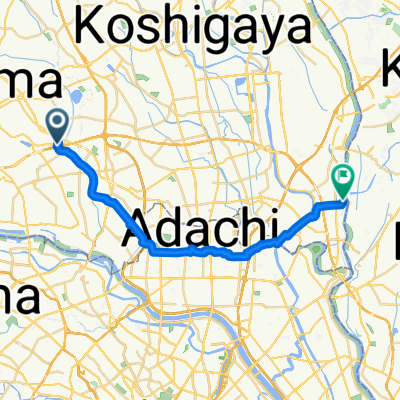
A cycling route starting in Hatogaya-honchō, Saitama, Japan.
Overview
About this route
Mostly flat with quiet roads, between cycling under beautiful trees with the river next to you there are areas of open farmlands with a great view of Saitama Shintoshin skyscrapers in the far distance. It is a very scenic and calm route.
- 1 h 12 min
- Duration
- 14.6 km
- Distance
- 63 m
- Ascent
- 67 m
- Descent
- 12.1 km/h
- Avg. speed
- ---
- Avg. speed
Route quality
Waytypes & surfaces along the route
Waytypes
Quiet road
8.2 km
(56 %)
Access road
3.1 km
(22 %)
Surfaces
Paved
4.9 km
(34 %)
Asphalt
3.2 km
(22 %)
Paved (undefined)
1.7 km
(12 %)
Undefined
9.7 km
(66 %)
Continue with Bikemap
Use, edit, or download this cycling route
You would like to ride Higashi Urawa River Cycle 東浦和近くの川 or customize it for your own trip? Here is what you can do with this Bikemap route:
Free features
- Save this route as favorite or in collections
- Copy & plan your own version of this route
- Sync your route with Garmin or Wahoo
Premium features
Free trial for 3 days, or one-time payment. More about Bikemap Premium.
- Navigate this route on iOS & Android
- Export a GPX / KML file of this route
- Create your custom printout (try it for free)
- Download this route for offline navigation
Discover more Premium features.
Get Bikemap PremiumFrom our community
Other popular routes starting in Hatogaya-honchō
- 芝川サイクリングロード〜見沼代用水東縁〜見沼自然公園〜〃西縁
- Distance
- 31.6 km
- Ascent
- 78 m
- Descent
- 66 m
- Location
- Hatogaya-honchō, Saitama, Japan
- BRM322-1
- Distance
- 153.1 km
- Ascent
- 990 m
- Descent
- 366 m
- Location
- Hatogaya-honchō, Saitama, Japan
- 763−2, 川口市 to 1丁目 20, 秩父市
- Distance
- 94 km
- Ascent
- 3,113 m
- Descent
- 2,878 m
- Location
- Hatogaya-honchō, Saitama, Japan
- Shibakawa Cycling Road
- Distance
- 15.5 km
- Ascent
- 96 m
- Descent
- 88 m
- Location
- Hatogaya-honchō, Saitama, Japan
- 13 芝川で「農」を体感するルート
- Distance
- 12.5 km
- Ascent
- 23 m
- Descent
- 25 m
- Location
- Hatogaya-honchō, Saitama, Japan
- 2丁目 23, 川口市 to 2丁目 23, さいたま市
- Distance
- 4.1 km
- Ascent
- 3 m
- Descent
- 0 m
- Location
- Hatogaya-honchō, Saitama, Japan
- Healthy Road へルーシロード
- Distance
- 13.6 km
- Ascent
- 36 m
- Descent
- 32 m
- Location
- Hatogaya-honchō, Saitama, Japan
- 18-17, Toneri 1-Chōme, Adachi to 9-7, Nakakasai 6-Chōme, Edogawa
- Distance
- 22.7 km
- Ascent
- 106 m
- Descent
- 110 m
- Location
- Hatogaya-honchō, Saitama, Japan
Open it in the app