

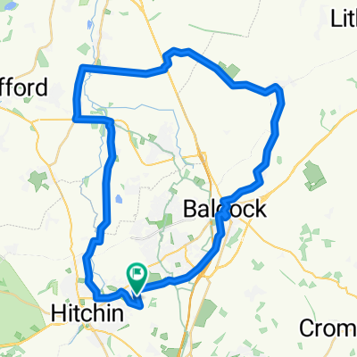
Willian-Wymondley loop
A cycling route starting in Hitchin, England, United Kingdom.
Overview
About this route
- -:--
- Duration
- 13 km
- Distance
- 91 m
- Ascent
- 91 m
- Descent
- ---
- Avg. speed
- ---
- Max. altitude
Route quality
Waytypes & surfaces along the route
Waytypes
Road
6.7 km
(52 %)
Quiet road
2.1 km
(16 %)
Surfaces
Paved
7.3 km
(56 %)
Unpaved
2.3 km
(18 %)
Asphalt
7.3 km
(56 %)
Ground
2.1 km
(16 %)
Continue with Bikemap
Use, edit, or download this cycling route
You would like to ride Willian-Wymondley loop or customize it for your own trip? Here is what you can do with this Bikemap route:
Free features
- Save this route as favorite or in collections
- Copy & plan your own version of this route
- Sync your route with Garmin or Wahoo
Premium features
Free trial for 3 days, or one-time payment. More about Bikemap Premium.
- Navigate this route on iOS & Android
- Export a GPX / KML file of this route
- Create your custom printout (try it for free)
- Download this route for offline navigation
Discover more Premium features.
Get Bikemap PremiumFrom our community
Other popular routes starting in Hitchin
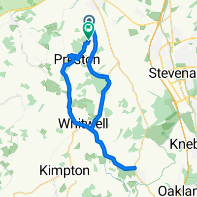 Preston Road, Hitchin to Preston Road, Hitchin
- Distance
- 22.5 km
- Ascent
- 253 m
- Descent
- 254 m
- Location
- Hitchin, England, United Kingdom
 Ransom Close 3 to Ransom Close 2
- Distance
- 15.2 km
- Ascent
- 100 m
- Descent
- 88 m
- Location
- Hitchin, England, United Kingdom
 Langford Tower Via Baldock
- Distance
- 40.6 km
- Ascent
- 283 m
- Descent
- 283 m
- Location
- Hitchin, England, United Kingdom
 Hitchin / Willian/ Letchworth / Ickleford circular
- Distance
- 16.2 km
- Ascent
- 126 m
- Descent
- 134 m
- Location
- Hitchin, England, United Kingdom
 Hitchin South Circular
- Distance
- 26.1 km
- Ascent
- 228 m
- Descent
- 208 m
- Location
- Hitchin, England, United Kingdom
 nice route
- Distance
- 12.6 km
- Ascent
- 80 m
- Descent
- 82 m
- Location
- Hitchin, England, United Kingdom
 67 Talbot St, Hitchin to 65 Talbot St, Hitchin
- Distance
- 23.9 km
- Ascent
- 134 m
- Descent
- 137 m
- Location
- Hitchin, England, United Kingdom
 Saint John's Road to Langbridge Close
- Distance
- 20.9 km
- Ascent
- 113 m
- Descent
- 168 m
- Location
- Hitchin, England, United Kingdom
Open it in the app