Rundtour mit Strandblick
- 70.4 km
- 176 m
- 178 m
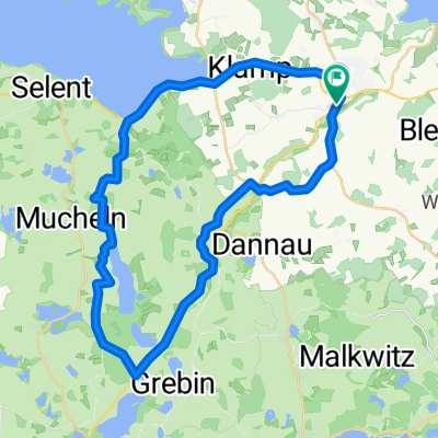
- Lütjenburg, Schleswig-Holstein, Germany
A cycling route starting in Lütjenburg, Schleswig-Holstein, Germany.
Overview
From Lütjenburg via secondary roads, field and forest paths east of Lake Selenter.
created this 5 years ago
Route quality
Track
20.9 km
(54 %)
Quiet road
10.8 km
(28 %)
Paved
9.3 km
(24 %)
Unpaved
20.5 km
(53 %)
Gravel
8.1 km
(21 %)
Asphalt
7.7 km
(20 %)
Continue with Bikemap
You would like to ride Ostwärts des Selenter See`s or customize it for your own trip? Here is what you can do with this Bikemap route:
Free trial for 3 days, or one-time payment. More about Bikemap Premium.
Discover more Premium features.
Get Bikemap PremiumFrom our community
Open it in the app