
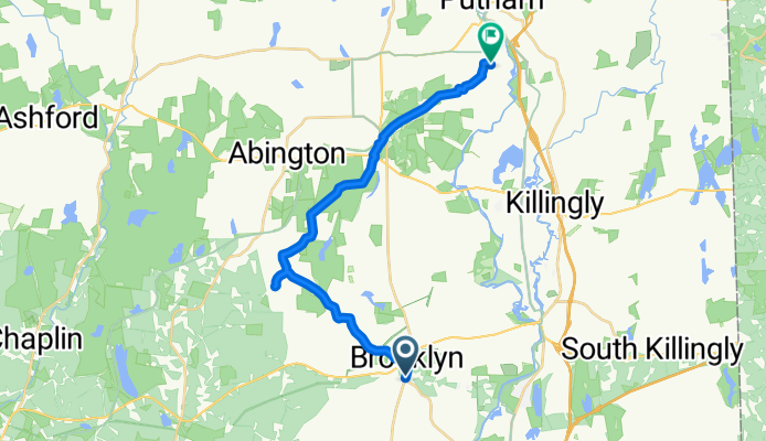
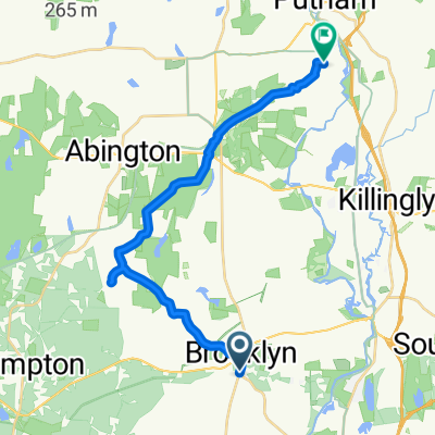
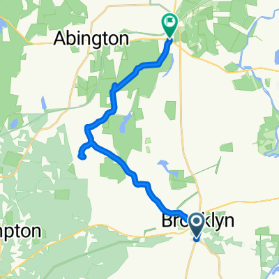
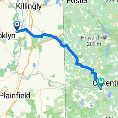
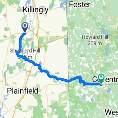
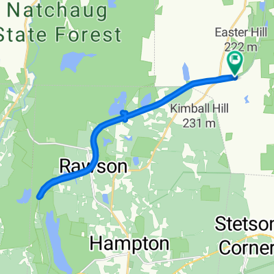
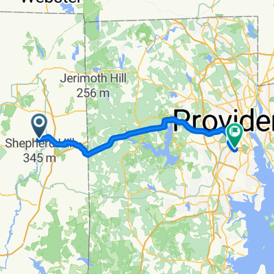
85 Canterbury Rd, Brooklyn to 1–33 Town Farm Rd, Putnam
A cycling route starting in East Brooklyn, Connecticut, United States of America.
Overview
About this route
- 1 h 17 min
- Duration
- 22 km
- Distance
- 260 m
- Ascent
- 230 m
- Descent
- 17.2 km/h
- Avg. speed
- ---
- Max. altitude
Route quality
Waytypes & surfaces along the route
Waytypes
Quiet road
18.6 km
(85 %)
Busy road
1.8 km
(8 %)
Surfaces
Paved
11.7 km
(53 %)
Unpaved
3.9 km
(18 %)
Asphalt
11.7 km
(53 %)
Unpaved (undefined)
3.9 km
(18 %)
Undefined
6.4 km
(29 %)
Continue with Bikemap
Use, edit, or download this cycling route
You would like to ride 85 Canterbury Rd, Brooklyn to 1–33 Town Farm Rd, Putnam or customize it for your own trip? Here is what you can do with this Bikemap route:
Free features
- Save this route as favorite or in collections
- Copy & plan your own version of this route
- Sync your route with Garmin or Wahoo
Premium features
Free trial for 3 days, or one-time payment. More about Bikemap Premium.
- Navigate this route on iOS & Android
- Export a GPX / KML file of this route
- Create your custom printout (try it for free)
- Download this route for offline navigation
Discover more Premium features.
Get Bikemap PremiumFrom our community
Other popular routes starting in East Brooklyn
 the ususa
- Distance
- 7.7 km
- Ascent
- 107 m
- Descent
- 119 m
- Location
- East Brooklyn, Connecticut, United States of America
 2023-1-28 Danielson
- Distance
- 27.4 km
- Ascent
- 87 m
- Descent
- 93 m
- Location
- East Brooklyn, Connecticut, United States of America
 85 Canterbury Rd, Brooklyn to 1–33 Town Farm Rd, Putnam
- Distance
- 22 km
- Ascent
- 260 m
- Descent
- 230 m
- Location
- East Brooklyn, Connecticut, United States of America
 23 RT-205, Brooklyn to 1–63 Wolf Den Dr, Pomfret Center
- Distance
- 16.9 km
- Ascent
- 542 m
- Descent
- 514 m
- Location
- East Brooklyn, Connecticut, United States of America
 479 Providence Rd, Brooklyn to 25 Old Summit Rd, Coventry
- Distance
- 26.4 km
- Ascent
- 355 m
- Descent
- 284 m
- Location
- East Brooklyn, Connecticut, United States of America
 Providence Road 479, Brooklyn to Old Summit Road 25, Coventry
- Distance
- 30.3 km
- Ascent
- 490 m
- Descent
- 419 m
- Location
- East Brooklyn, Connecticut, United States of America
 Brooklyn Road 77, Pomfret to Brooklyn Road 77, Pomfret
- Distance
- 17.8 km
- Ascent
- 41 m
- Descent
- 38 m
- Location
- East Brooklyn, Connecticut, United States of America
 Providence Road 479, Brooklyn to Park Avenue 869, Cranston
- Distance
- 49 km
- Ascent
- 821 m
- Descent
- 869 m
- Location
- East Brooklyn, Connecticut, United States of America
Open it in the app