

Aachen-Köln
A cycling route starting in Aachen, North Rhine-Westphalia, Germany.
Overview
About this route
von Aachen nach Köln (Rodenkirchen, Porz)
- -:--
- Duration
- 97.4 km
- Distance
- 385 m
- Ascent
- 527 m
- Descent
- ---
- Avg. speed
- 298 m
- Max. altitude
Route quality
Waytypes & surfaces along the route
Waytypes
Busy road
28.2 km
(29 %)
Quiet road
24.3 km
(25 %)
Surfaces
Paved
73.8 km
(76 %)
Unpaved
1.5 km
(2 %)
Asphalt
63.5 km
(65 %)
Paved (undefined)
8.8 km
(9 %)
Continue with Bikemap
Use, edit, or download this cycling route
You would like to ride Aachen-Köln or customize it for your own trip? Here is what you can do with this Bikemap route:
Free features
- Save this route as favorite or in collections
- Copy & plan your own version of this route
- Split it into stages to create a multi-day tour
- Sync your route with Garmin or Wahoo
Premium features
Free trial for 3 days, or one-time payment. More about Bikemap Premium.
- Navigate this route on iOS & Android
- Export a GPX / KML file of this route
- Create your custom printout (try it for free)
- Download this route for offline navigation
Discover more Premium features.
Get Bikemap PremiumFrom our community
Other popular routes starting in Aachen
 12-01-17 Kleine Mergellandrunde 47km-629hm
- Distance
- 47.5 km
- Ascent
- 473 m
- Descent
- 473 m
- Location
- Aachen, North Rhine-Westphalia, Germany
 Zweifall +Hohes Venn
- Distance
- 69.6 km
- Ascent
- 564 m
- Descent
- 564 m
- Location
- Aachen, North Rhine-Westphalia, Germany
 nice MTB route
- Distance
- 21.7 km
- Ascent
- 442 m
- Descent
- 450 m
- Location
- Aachen, North Rhine-Westphalia, Germany
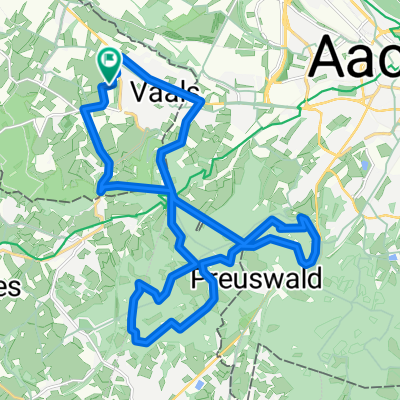 Vaals - Op jacht in het Preuswald
- Distance
- 23.6 km
- Ascent
- 424 m
- Descent
- 425 m
- Location
- Aachen, North Rhine-Westphalia, Germany
 Durch den Aachener Stadtwald
- Distance
- 26.7 km
- Ascent
- 320 m
- Descent
- 320 m
- Location
- Aachen, North Rhine-Westphalia, Germany
 Vennbahn Bike Path
- Distance
- 127.6 km
- Ascent
- 1,253 m
- Descent
- 1,014 m
- Location
- Aachen, North Rhine-Westphalia, Germany
 TJs extreme :)
- Distance
- 50.6 km
- Ascent
- 615 m
- Descent
- 612 m
- Location
- Aachen, North Rhine-Westphalia, Germany
 Aachen-Maastricht-Aachen
- Distance
- 89.7 km
- Ascent
- 702 m
- Descent
- 702 m
- Location
- Aachen, North Rhine-Westphalia, Germany
Open it in the app